MyTopo
Bakersfield Missouri US Topo Map
Couldn't load pickup availability
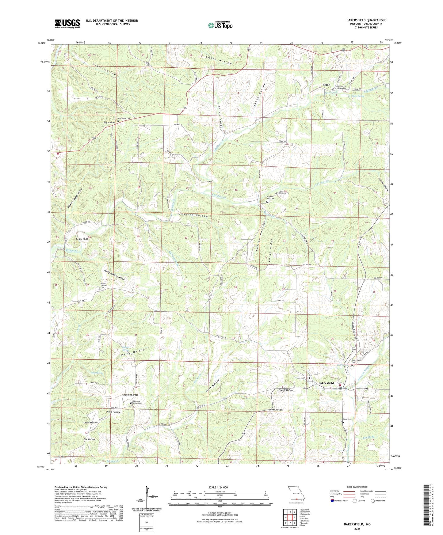
2021 topographic map quadrangle Bakersfield in the state of Missouri. Scale: 1:24000. Based on the newly updated USGS 7.5' US Topo map series, this map is in the following counties: Ozark. The map contains contour data, water features, and other items you are used to seeing on USGS maps, but also has updated roads and other features. This is the next generation of topographic maps. Printed on high-quality waterproof paper with UV fade-resistant inks.
Quads adjacent to this one:
West: Udall
Northwest: Sycamore
North: Cureall NW
Northeast: Pottersville
East: Caulfield
Southeast: Gepp
South: Gamaliel
Southwest: Clarkridge
Contains the following named places: Bakersfield, Bakersfield Post Office, Bakersfield Volunteer Fire Department, Baptist Hill Church, Barren Creek School, Blair Hollow, Bluff Spring, Brown Hollow, Butram Hollow, Cedar Bluff, Central Plateau, Cold Springs Church, Elijah, Fairview School, Fore Cemetery, Gillette Hollow, Halford Spring, Hasty Pudding Hollow, Hawkins Ridge, Hawkins Ridge Church, Hawkins Ridge School, Hickory Stump Hollow, Manes Hollow, Mineral Point Church, Mount Pleasant Church, Needle Branch, North Bridges Creek, Paint Ridge, Petty Hollow, Petty Spring, Plumb Hollow, Plumb Hollow School, Rattlesnake Branch, Roberts Branch, Scofield Hollow, Sharp, Sharp Post Office, South Bridges Creek, Spoon Spring, Taylor Spring, Tecumseh Lookout Tower, Tecumseh Volunteer Fire Department, Thuroy, Township of Bayou I, Township of Bayou II, Vaughn, Vaughn Post Office, Village of Bakersfield, White Oak Cemetery, Wolf Hollow, ZIP Codes: 65609, 65626