MyTopo
Fair Grove Missouri US Topo Map
Couldn't load pickup availability
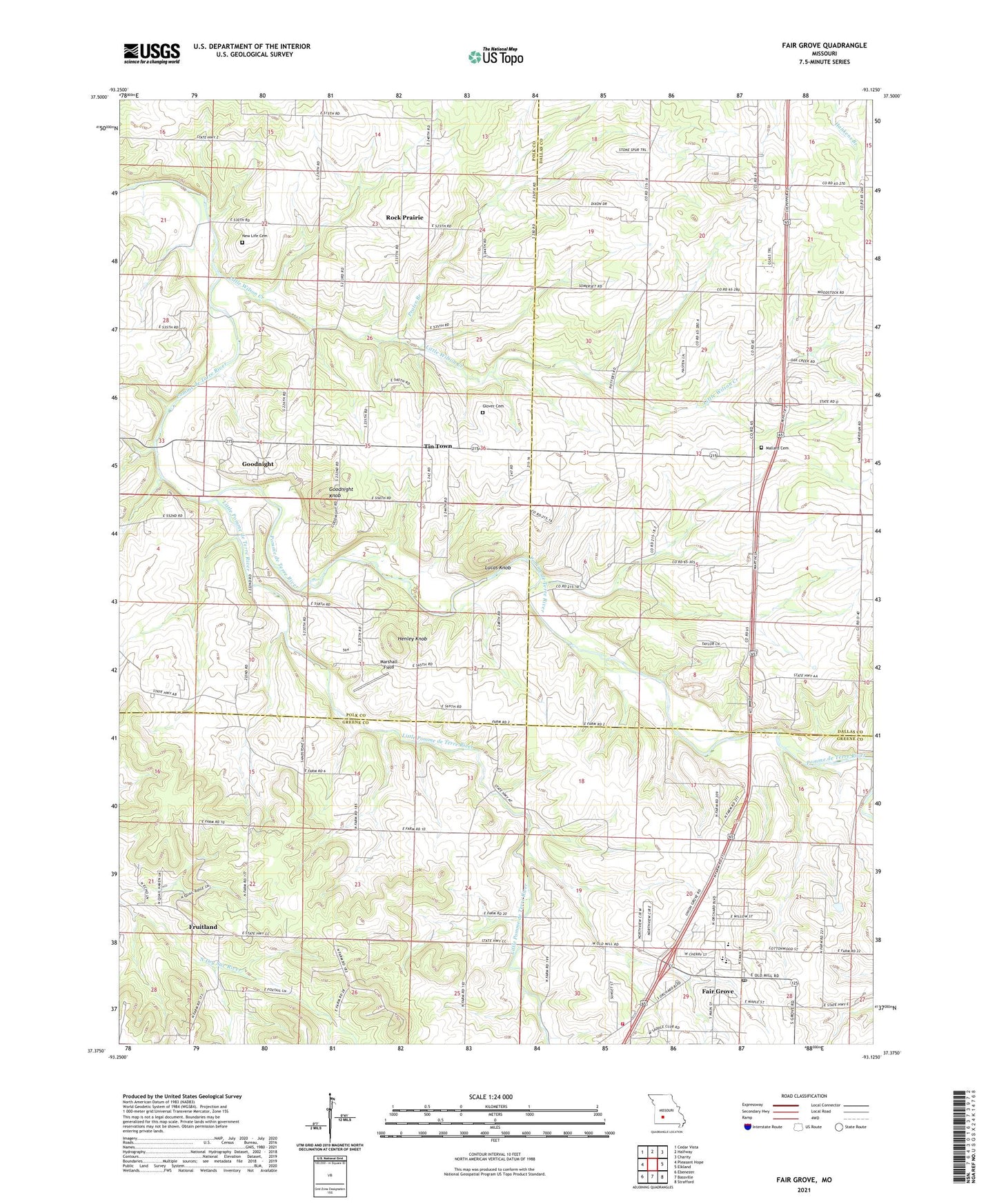
2021 topographic map quadrangle Fair Grove in the state of Missouri. Scale: 1:24000. Based on the newly updated USGS 7.5' US Topo map series, this map is in the following counties: Polk, Greene, Dallas. The map contains contour data, water features, and other items you are used to seeing on USGS maps, but also has updated roads and other features. This is the next generation of topographic maps. Printed on high-quality waterproof paper with UV fade-resistant inks.
Quads adjacent to this one:
West: Pleasant Hope
Northwest: Cedar Vista
North: Halfway
Northeast: Charity
East: Elkland
Southeast: Strafford
South: Bassville
Southwest: Ebenezer
This map covers the same area as the classic USGS quad with code o37093d2.
Contains the following named places: Blackoak School, City of Fair Grove, Fair Grove, Fair Grove Fire Protection District, Fair Grove Post Office, Fruitland, Fruitland Church, Glover Cemetery, Goodnight, Goodnight Knob, Hasten School, Henley Knob, High Prairie, High Prairie Church, Little Pomme de Terre River, Little Wilson Creek, Lucas Knob, Mallard Cemetery, Marshall Field, New Garden School, New Life Cemetery, Persimmon Grove School, Prater Branch, Rock Prairie, Rock Prairie Church, Rock Prairie School, Sunnyvale Church, Tin Town, Township of Sheridan, Union Grove Church, Union Grove School, Village of Goodnight, ZIP Code: 65648