MyTopo
Halfway Missouri US Topo Map
Couldn't load pickup availability
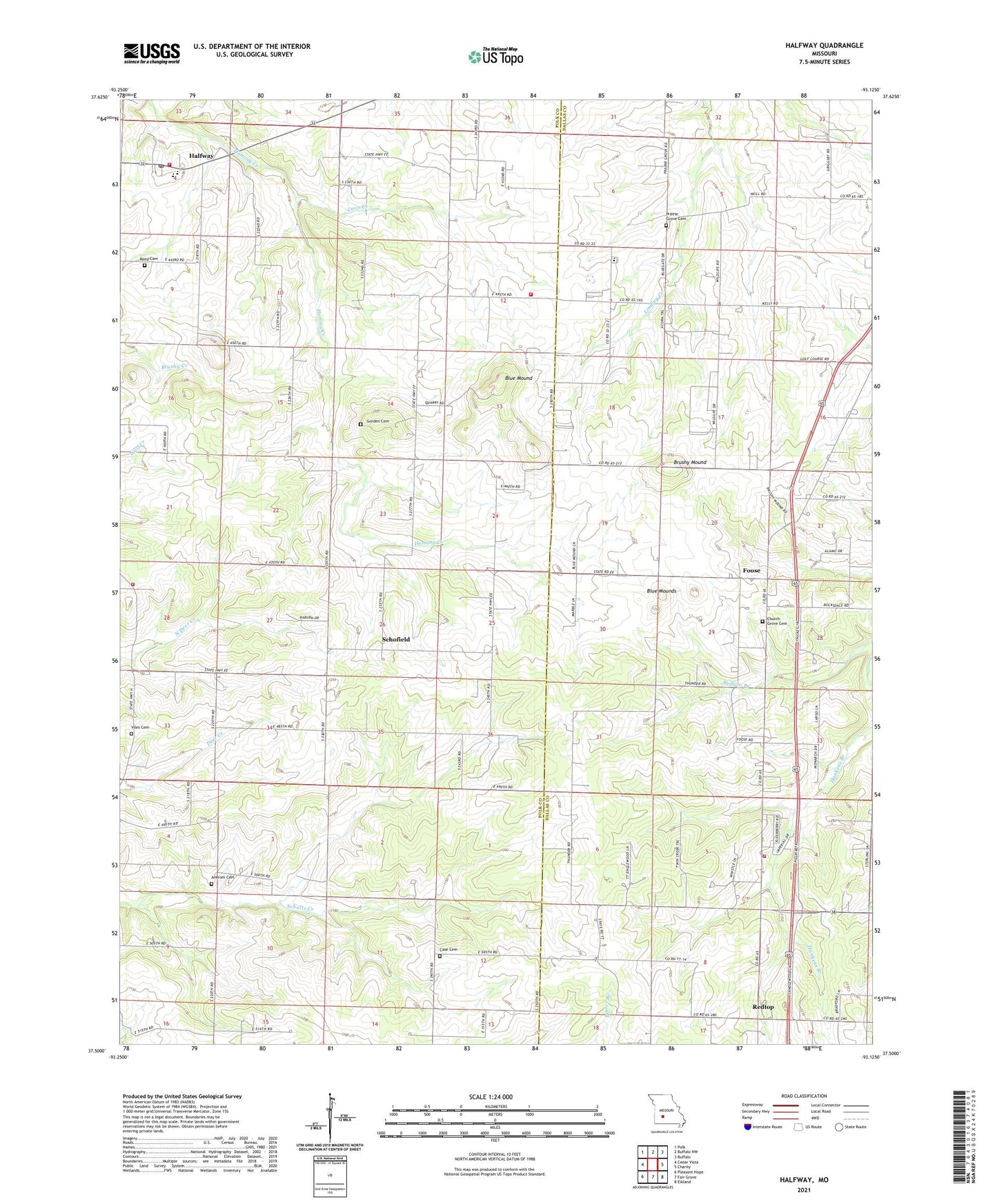
2021 topographic map quadrangle Halfway in the state of Missouri. Scale: 1:24000. Based on the newly updated USGS 7.5' US Topo map series, this map is in the following counties: Polk, Dallas. The map contains contour data, water features, and other items you are used to seeing on USGS maps, but also has updated roads and other features. This is the next generation of topographic maps. Printed on high-quality waterproof paper with UV fade-resistant inks.
Quads adjacent to this one:
West: Cedar Vista
Northwest: Polk
North: Buffalo NW
Northeast: Buffalo
East: Charity
Southeast: Elkland
South: Fair Grove
Southwest: Pleasant Hope
This map covers the same area as the classic USGS quad with code o37093e2.
Contains the following named places: Ankrom Cemetery, Bloomer School, Blue Mound, Blue Mounds, Brushy Mound, Case Cemetery, Church Grove Cemetery, Church Grove Church, Consolidated School Number 8, Coon Creek, Foose, Gorden Cemetery, Half Way Post Office, Halfway, Halfway Volunteer Fire Department Station 1, Halfway Volunteer Fire Department Station 2, Kelly School, Knapp School, Pig Field, Prairie Grove Cemetery, Prairie Grove Church, Prairie Grove Fire Department, Prairie View School, Redtop, Redtop Church, Reed Cemetery, Rex, Schofield, Schofield School, Southern Dallas County Fire Protection District, Township of South Benton, Viles Cemetery, Village of Halfway, ZIP Code: 65663