MyTopo
Cabool SW Missouri US Topo Map
Couldn't load pickup availability
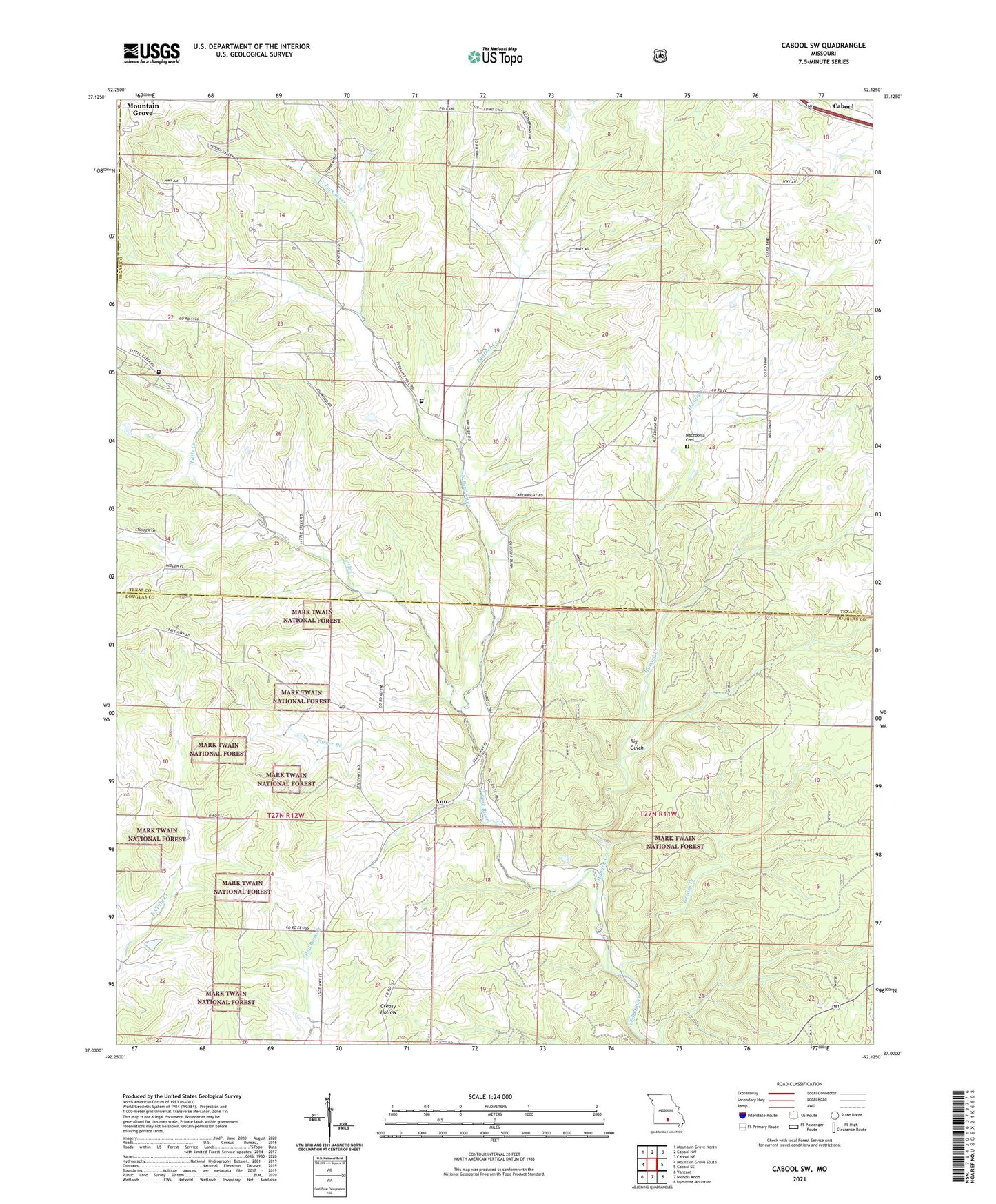
2021 topographic map quadrangle Cabool SW in the state of Missouri. Scale: 1:24000. Based on the newly updated USGS 7.5' US Topo map series, this map is in the following counties: Texas, Douglas, Wright. The map contains contour data, water features, and other items you are used to seeing on USGS maps, but also has updated roads and other features. This is the next generation of topographic maps. Printed on high-quality waterproof paper with UV fade-resistant inks.
Quads adjacent to this one:
West: Mountain Grove South
Northwest: Mountain Grove North
North: Cabool NW
Northeast: Cabool NE
East: Cabool SE
Southeast: Dyestone Mountain
South: Nichols Knob
Southwest: Vanzant
Contains the following named places: Ann, Big Gulch, Cherry Point School, Excelsior School, Fairview Church, Greasy Creek, Gum Spring School, Hungry Creek, Little Creek, Little Creek School, Lone Star School, Macedonia Cemetery, Oak Grove School, Panther Creek, Parker Branch, Pine Flat School, Pleasant Hill Church, Pleasant Hill School, Shady Grove School, Township of Clinton, Union Chapel