MyTopo
Dyestone Mountain Missouri US Topo Map
Couldn't load pickup availability
Also explore the Dyestone Mountain Forest Service Topo of this same quad for updated USFS data
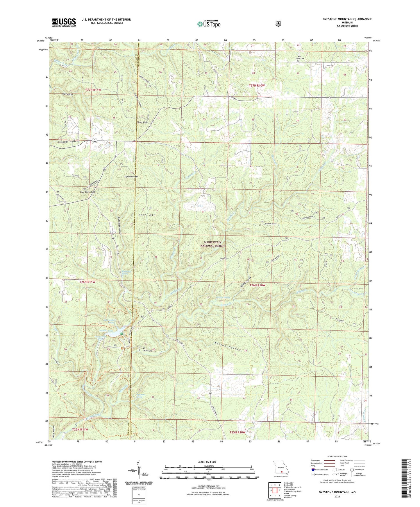
2021 topographic map quadrangle Dyestone Mountain in the state of Missouri. Scale: 1:24000. Based on the newly updated USGS 7.5' US Topo map series, this map is in the following counties: Howell, Douglas. The map contains contour data, water features, and other items you are used to seeing on USGS maps, but also has updated roads and other features. This is the next generation of topographic maps. Printed on high-quality waterproof paper with UV fade-resistant inks.
Quads adjacent to this one:
West: Nichols Knob
Northwest: Cabool SW
North: Cabool SE
Northeast: Willow Springs North
East: Willow Springs South
Southeast: Pomona
South: Siloam Springs
Southwest: Dora
This map covers the same area as the classic USGS quad with code o36092h1.
Contains the following named places: Blue Buck Knob, Blue Buck Lookout Tower, Blue Rock Church, Brushy Creek, C C C Camp, Carman Spring, Carmen Springs Wildlife Refuge Management Area, Carroll Cemetery, Clearwater Reach Picnic Area, Cord Hollow, Crooked Creek, Dry Creek Church, Dyestone Mountain, Fern Glen School, Fern Ridge School, Fields Store, Flatrock School, Fox Hollow, Galloway Spring, Group Camp Spring, Hellroaring Spring, Little Indian Creek, Middle Indian Creek, Noblett Creek, Noblett Lake, Noblett Lake Campground, Noblett Lake Dam, Noblett Mill, Noblett School, Noblett Trailhead, North Fork Spring Creek, Ozarks, Pine Grove Church, Pine Grove School, Pleasant Hill School, Poison Hollow, Rockhouse Hollow, Rockhouse Spring, South Fork Spring Creek, Sparkling Hollow, Spring Hollow, Sugar Hill Campground, Tater Hill, Twin Mountain, West Liberty School, Willow Springs Ranger District, Wolf Hollow