MyTopo
Barnett Missouri US Topo Map
Couldn't load pickup availability
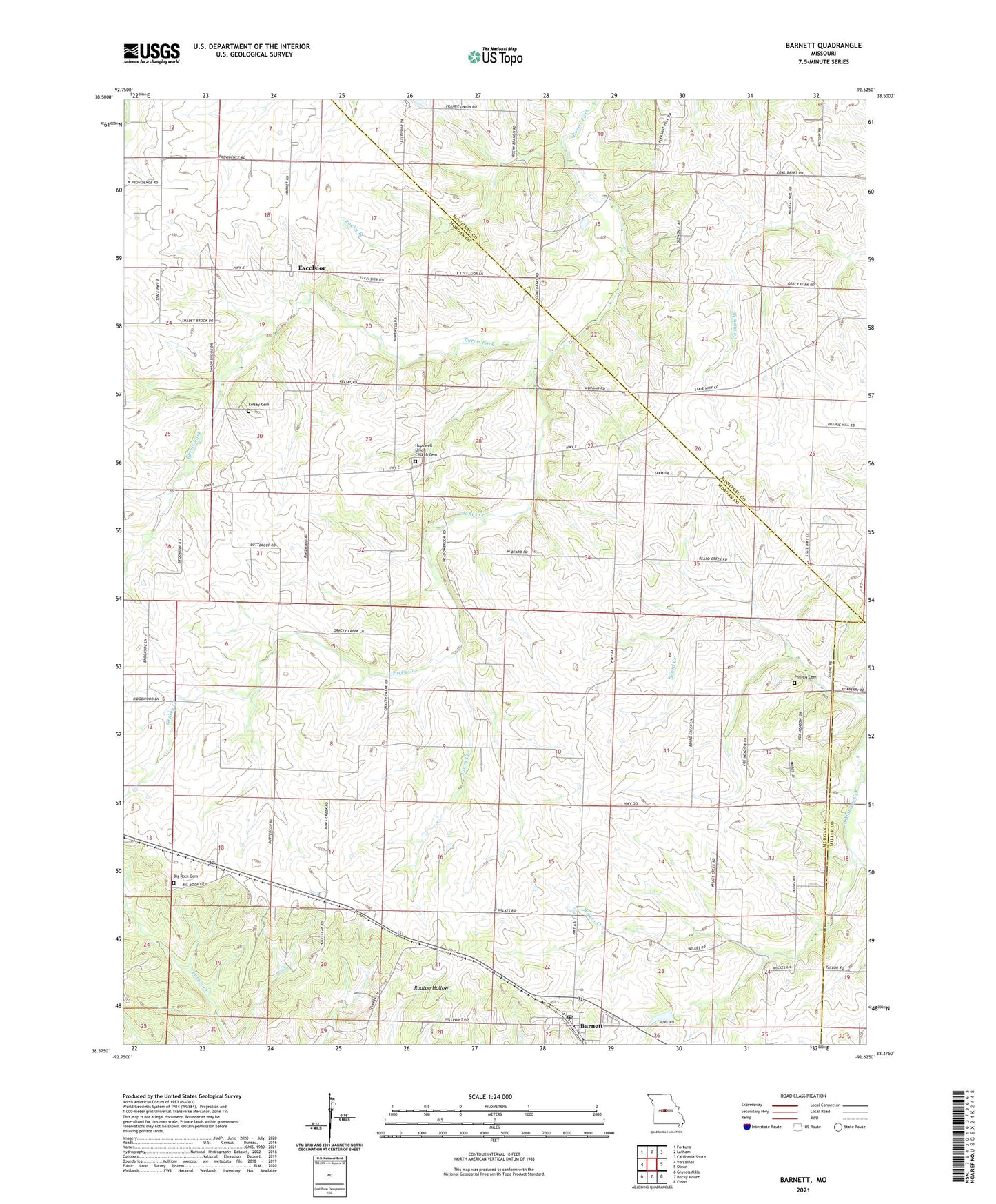
2021 topographic map quadrangle Barnett in the state of Missouri. Scale: 1:24000. Based on the newly updated USGS 7.5' US Topo map series, this map is in the following counties: Morgan, Moniteau, Miller. The map contains contour data, water features, and other items you are used to seeing on USGS maps, but also has updated roads and other features. This is the next generation of topographic maps. Printed on high-quality waterproof paper with UV fade-resistant inks.
Quads adjacent to this one:
West: Versailles
Northwest: Fortuna
North: Latham
Northeast: California South
East: Olean
Southeast: Eldon
South: Rocky Mount
Southwest: Gravois Mills
This map covers the same area as the classic USGS quad with code o38092d6.
Contains the following named places: Barnett, Barnett Post Office, Big Rock Cemetery, Big Rock Church, City of Barnett, Coal Bank Ford, East Prairie School, Excelsior, Goodman School, Gracey Creek, Hale School, Hopewell School, Hopewell Union Church, Hopewell Union Church Cemetery, Jones Creek, Kelsay Cemetery, Lone Jack School, Parkes School, Phillips Cemetery, Prairie Grove School, Prairie Union School, Providence School, Rocky Branch, Simpson Mine, Wilkes Creek, Yows Lake Dam, ZIP Code: 65011