MyTopo
Hills Store Missouri US Topo Map
Couldn't load pickup availability
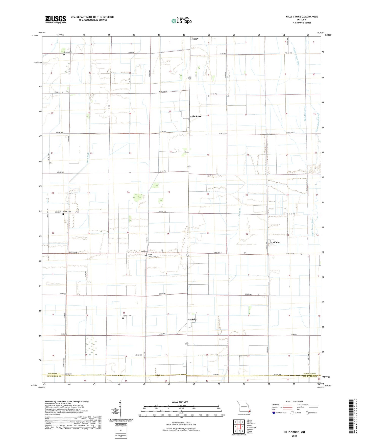
2021 topographic map quadrangle Hills Store in the state of Missouri. Scale: 1:24000. Based on the newly updated USGS 7.5' US Topo map series, this map is in the following counties: Stoddard, New Madrid. The map contains contour data, water features, and other items you are used to seeing on USGS maps, but also has updated roads and other features. This is the next generation of topographic maps. Printed on high-quality waterproof paper with UV fade-resistant inks.
Quads adjacent to this one:
West: Bernie
Northwest: Dexter
North: Essex
Northeast: Morehouse
East: Charter Oak
Southeast: Catron
South: Parma
Southwest: Malden
Contains the following named places: Barker Cemetery, Boyt Church, Boyt School, Bradhams, Caney Creek, Cravins Cemetery, Ditch Number 41, Ditch Number 42, Ditch Number 43, Ditch Number 8, Frisco School, Hills Store, Hopewell Church, Ivester Cemetery, LaValle, Main Ditch, Marco, Marco School, Maulsby, Radcliffe Landing Strip, Stones Chapel Cemetery, Township of Elk, Trammel School, Vinson Church, Vinson School, Walker School, West Pryor School