MyTopo
Main City Missouri US Topo Map
Couldn't load pickup availability
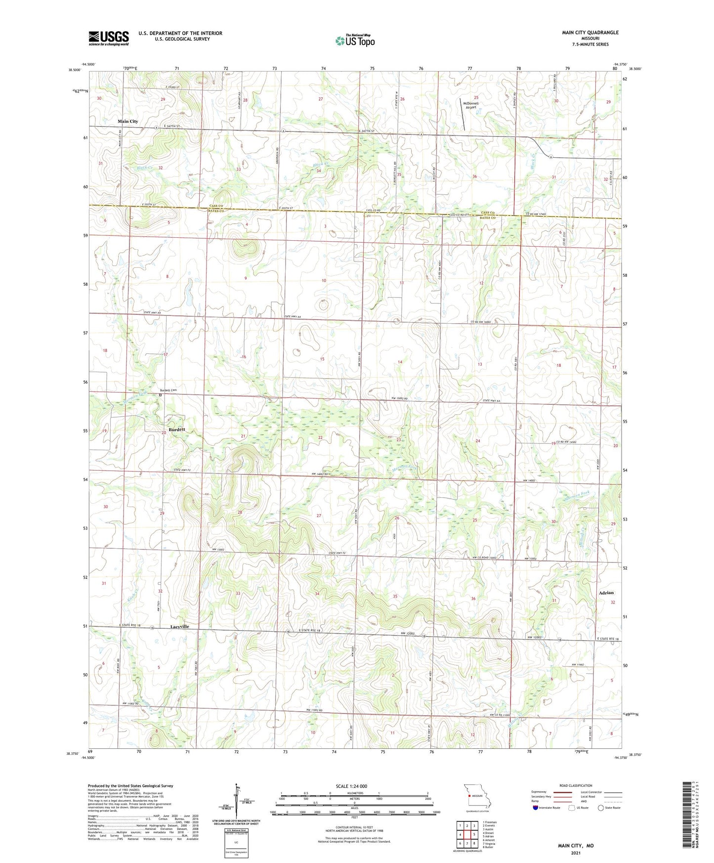
2021 topographic map quadrangle Main City in the state of Missouri. Scale: 1:24000. Based on the newly updated USGS 7.5' US Topo map series, this map is in the following counties: Bates, Cass. The map contains contour data, water features, and other items you are used to seeing on USGS maps, but also has updated roads and other features. This is the next generation of topographic maps. Printed on high-quality waterproof paper with UV fade-resistant inks.
Quads adjacent to this one:
West: Drexel
Northwest: Freeman
North: Everett
Northeast: Austin
East: Adrian
Southeast: Butler
South: Virginia
Southwest: Amoret
Contains the following named places: Buckhorn School, Burdett, Burdett Cemetery, Burdett School, Dixie School, Everett School, Fairview Church, Fairview School, Green Valley School, Lacyville, Main City, Main City School, McDonnell Airport, McNeil School, Millsap Creek, Silverdale School, Township of East Boone