MyTopo
Freeman Missouri US Topo Map
Couldn't load pickup availability
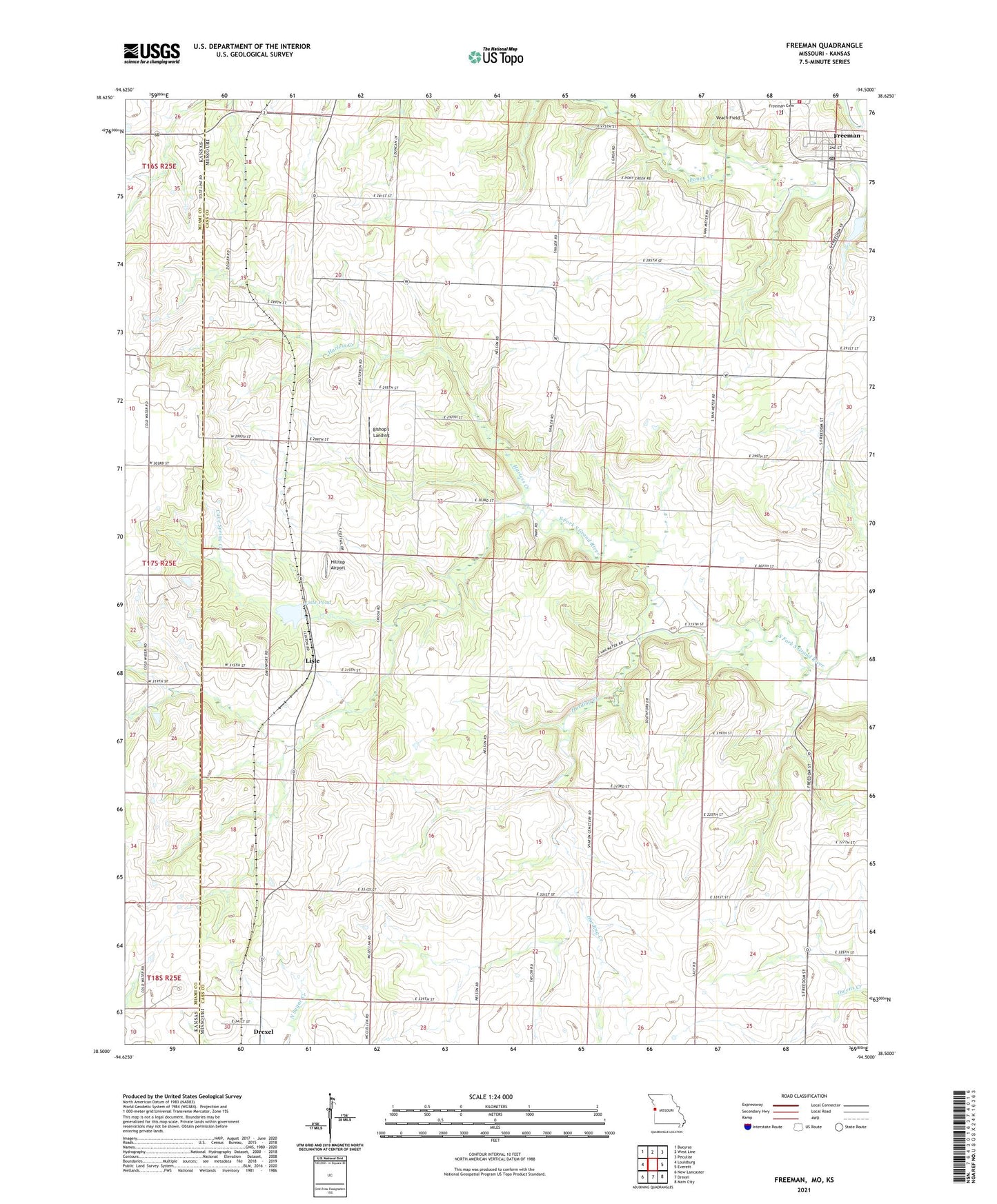
2021 topographic map quadrangle Freeman in the state of Missouri. Scale: 1:24000. Based on the newly updated USGS 7.5' US Topo map series, this map is in the following counties: Cass, Miami. The map contains contour data, water features, and other items you are used to seeing on USGS maps, but also has updated roads and other features. This is the next generation of topographic maps. Printed on high-quality waterproof paper with UV fade-resistant inks.
Quads adjacent to this one:
West: Louisburg
Northwest: Bucyrus
North: West Line
Northeast: Peculiar
East: Everett
Southeast: Main City
South: Drexel
Southwest: New Lancaster
This map covers the same area as the classic USGS quad with code o38094e5.
Contains the following named places: Bishop's Landing, Calvert School, Cave Spring Creek, Chaffin Lake, Chaffin Lake Dam, City of Drexel, City of Freeman, Coldwater Creek, Coldwater School, Cook Lake, Cook Lake Dam, Dodge Point School, Dolan West Dolan Fire Protection District Main Station, Freeman, Freeman Cemetery, Freeman Post Office, Freeman School, Glendale School, Harding Creek, Harless Creek, Heine Lake, Heine Lake Dam, Hilltop Airport, Liberty School, Lisle, Lisle Pond, Lisle Pond Dam, Shiloh Chapel, South Fork Church, Township of Coldwater, Township of West Dolan, Van Meter School, ZIP Code: 64742