MyTopo
Montier Missouri US Topo Map
Couldn't load pickup availability
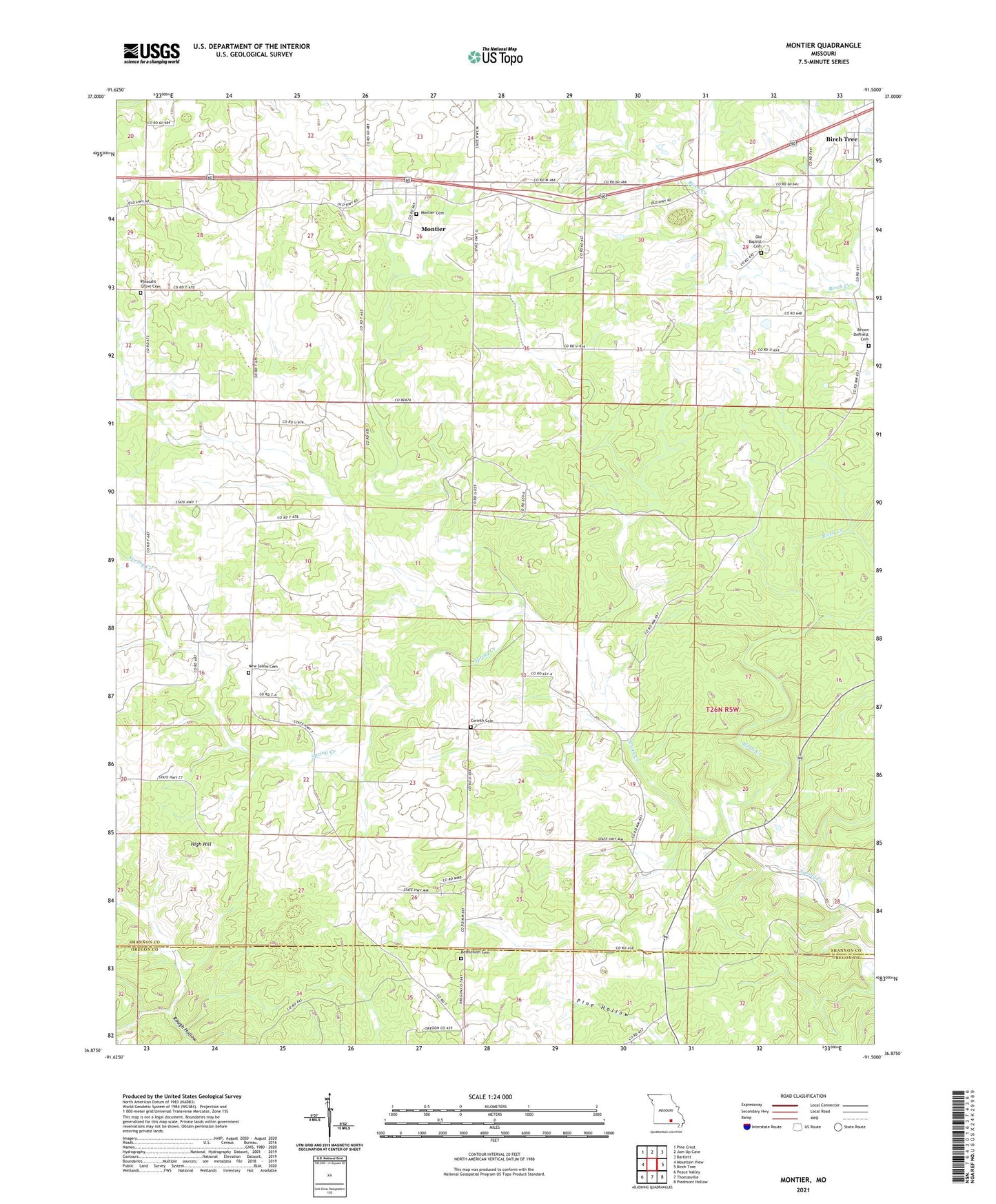
2021 topographic map quadrangle Montier in the state of Missouri. Scale: 1:24000. Based on the newly updated USGS 7.5' US Topo map series, this map is in the following counties: Shannon, Oregon. The map contains contour data, water features, and other items you are used to seeing on USGS maps, but also has updated roads and other features. This is the next generation of topographic maps. Printed on high-quality waterproof paper with UV fade-resistant inks.
Quads adjacent to this one:
West: Mountain View
Northwest: Pine Crest
North: Jam Up Cave
Northeast: Bartlett
East: Birch Tree
Southeast: Piedmont Hollow
South: Thomasville
Southwest: Peace Valley
This map covers the same area as the classic USGS quad with code o36091h5.
Contains the following named places: Bethlehem Cemetery, Bethlehem Church, Birch Creek, Brown - DePriest Cemetery, Congo, Congo School, Corinth Church, Corinth School, County Line Church, High Hill, Hunter Hill School, KBMV-AM (Birch Tree), KBMV-FM (Birch Tree), Marble Hill School, Montier, Montier Census Designated Place, Mount Calvary Church, New Salem Cemetery, Not, Pleasant Grove Church, Thomasville Tower Site, Township of Spring Creek, ZIP Code: 65438