MyTopo
Rocky Mount Missouri US Topo Map
Couldn't load pickup availability
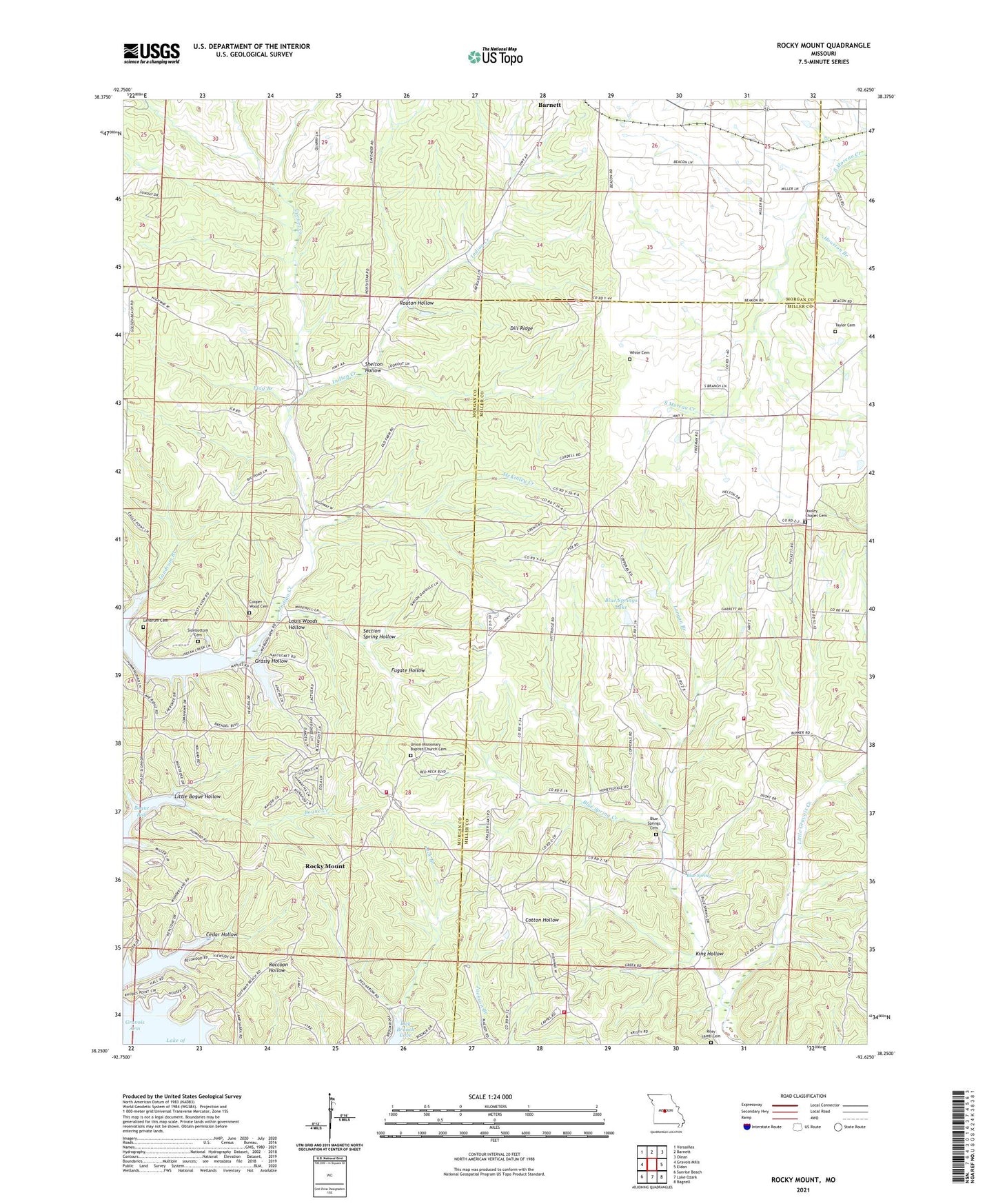
2021 topographic map quadrangle Rocky Mount in the state of Missouri. Scale: 1:24000. Based on the newly updated USGS 7.5' US Topo map series, this map is in the following counties: Morgan, Miller. The map contains contour data, water features, and other items you are used to seeing on USGS maps, but also has updated roads and other features. This is the next generation of topographic maps. Printed on high-quality waterproof paper with UV fade-resistant inks.
Quads adjacent to this one:
West: Gravois Mills
Northwest: Versailles
North: Barnett
Northeast: Olean
East: Eldon
Southeast: Bagnell
South: Lake Ozark
Southwest: Sunrise Beach
This map covers the same area as the classic USGS quad with code o38092c6.
Contains the following named places: Blue Spring, Blue Spring Creek, Blue Springs Cemetery, Blue Springs Church, Blue Springs Lake, Bogue Creek, Cedar Hollow, Central Point School, Cooper - Wood Cemetery, Cornet Creek, Dill Ridge, Dooley Chapel, Dooley Chapel Cemetery, Flag Branch, Fugate Hollow, Grassy Hollow, Holder School, Houston Branch, Indian Creek, Indian Creek Hills Incorporated Lake Dam, King Hollow, Landrum Branch, Landrum Cemetery, Laurel Ridge School, Lick Branch, Little Bogue Hollow, Longan Branch, Louis Woods Hollow, McKinley Creek, McKinley School, Riley Lamb Cemetery, Rock Island School, Rocky Mount, Rocky Mount Church, Rocky Mount Fire Protection District Station 1, Rocky Mount Fire Protection District Station 2, Rocky Mount Fire Protection District Station 4, Rocky Mount Lookout Tower, Rocky Mount Post Office, Rocky Mount Towersite State Wildlife Area, Routon Hollow, Routon School, Section Spring Hollow, Shelton Hollow, Sidebottom Cemetery, Stover Mine, Taylor Cemetery, Taylor School, Union Church, Union Missionary Baptist Church Cemetery, White Cemetery, ZIP Code: 65072