MyTopo
Eldon Missouri US Topo Map
Couldn't load pickup availability
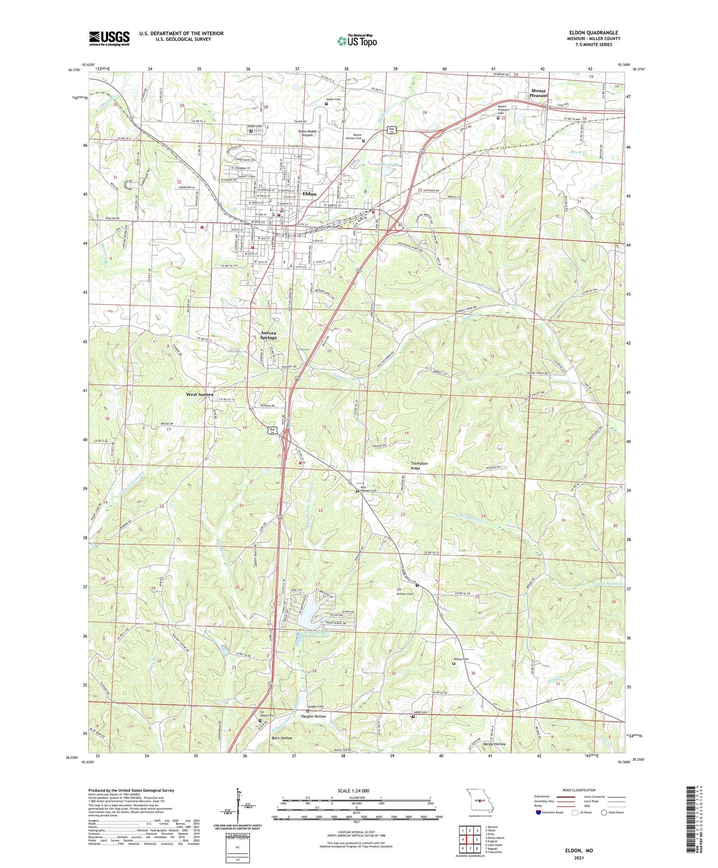
2021 topographic map quadrangle Eldon in the state of Missouri. Scale: 1:24000. Based on the newly updated USGS 7.5' US Topo map series, this map is in the following counties: Miller. The map contains contour data, water features, and other items you are used to seeing on USGS maps, but also has updated roads and other features. This is the next generation of topographic maps. Printed on high-quality waterproof paper with UV fade-resistant inks.
Quads adjacent to this one:
West: Rocky Mount
Northwest: Barnett
North: Olean
Northeast: Enon
East: Eugene
Southeast: Tuscumbia
South: Bagnell
Southwest: Lake Ozark
This map covers the same area as the classic USGS quad with code o38092c5.
Contains the following named places: Artz - Wenzel Cemetery, Aurora Springs, Aurora Springs Census Designated Place, Barn Hollow, City of Eldon, Cooper, Cooper School, Dry Branch, Eldon, Eldon Cemetery, Eldon Fire Department Station 1 Headquarters, Eldon Fire Department Station 2, Eldon Fire Department Station 3, Eldon High School, Eldon Junior High School, Eldon Model Airpark, Eldon Police Department, Eldon Post Office, Franklin School, Gateway Church, Ginger Ridge School, Harmony School, Jukes Cemetery, Kelsay Cemetery, KKNO-FM (Eldon), KLDN-FM (Eldon), Lake Ja-Ha, Lake Ja-Ha Dam, Land of Lakes Incorporated, Milldale Church, Moreau Fire Protection District Station 1, Moreau Fire Protection District Station 6, Mount Carmel Church, Mount Pleasant, Mount Pleasant Cemetery, Mount Vernon Cemetery, Old Path Church, Pleasant Hill School, Salem Cemetery, Skinner Cemetery, Skinner School, Thompson Ridge, Tol - Wood Cemetery, Town-N-Country Lake Dam, Township of Franklin, Township of Saline, Tri-County Tech School, Vaughn Cemetery, Vaughn Hollow, Vernon School, Walnut Grove School, West Aurora, West Aurora School, ZIP Code: 65026