MyTopo
Shearwood Missouri US Topo Map
Couldn't load pickup availability
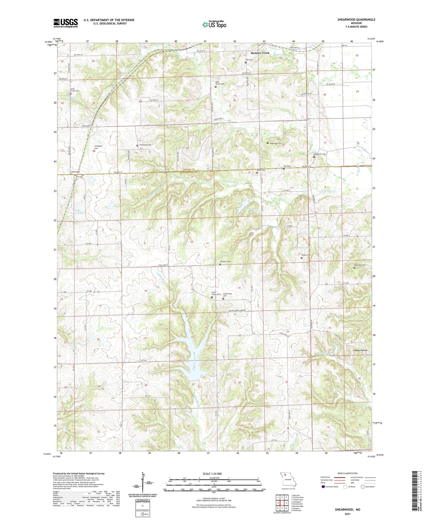
2021 topographic map quadrangle Shearwood in the state of Missouri. Scale: 1:24000. Based on the newly updated USGS 7.5' US Topo map series, this map is in the following counties: Livingston, Grundy. The map contains contour data, water features, and other items you are used to seeing on USGS maps, but also has updated roads and other features. This is the next generation of topographic maps. Printed on high-quality waterproof paper with UV fade-resistant inks.
Quads adjacent to this one:
West: Jamesport
Northwest: Bancroft
North: Trenton West
Northeast: Trenton East
East: Farmersville
Southeast: Chillicothe
South: Sampsel
Southwest: Breckenridge
Contains the following named places: Blackburn School, Center School, Cisco, Cisco Post Office, Coburn, Coy Cemetery, Davis Cemetery, Dockery Cemetery, Fair Lake Dam, Fender Farms Lake, Fender Farms Lake Dam North, Fender Farms Lake East Dam, Fender Farms Lake West Dam, Gee Cemetery, Gees Creek Cemetery, Gees School, Genova, Genova Post Office, Goodrich School, Haynes Lake Dam, Hickory Creek, Hicks School, Hosman School, Hutchinson Cemetery, Kennedy Cemetery, Lilly Grove Cemetery, Lily Grove Church, Livingston Cemetery, Matt Green Cemetery, McDonnal Lake Dam, Mount Pleasant School, Muddy Lane, Pike Lake, Pike Lake Dam, Pinkley School, Poosey State Forest, Prothero School, Reeter Lake Dam, Rinehart Lake, Rinehart Lake Dam, Rosson Cemetery, Shearwood, Shelburn Church, Shelburne Cemetery, South Fork Gees Creek, Thompson Cemetery, Township of Jackson, Township of Jefferson, Trager Lake, Trager Lake West Dam, Ware School, Woldridge Cemetery