MyTopo
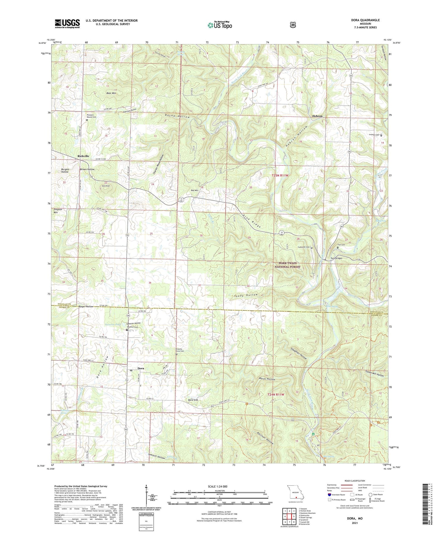
Dora Missouri US Topo Map
Couldn't load pickup availability
Also explore the Dora Forest Service Topo of this same quad for updated USFS data
2021 topographic map quadrangle Dora in the state of Missouri. Scale: 1:24000. Based on the newly updated USGS 7.5' US Topo map series, this map is in the following counties: Douglas, Ozark. The map contains contour data, water features, and other items you are used to seeing on USGS maps, but also has updated roads and other features. This is the next generation of topographic maps. Printed on high-quality waterproof paper with UV fade-resistant inks.
Quads adjacent to this one:
West: Gentryville
Northwest: Vanzant
North: Nichols Knob
Northeast: Dyestone Mountain
East: Siloam Springs
Southeast: Pottersville
South: Cureall NW
Southwest: Sycamore
This map covers the same area as the classic USGS quad with code o36092g2.
Contains the following named places: Bear Mountain, Bethany Church, Bethany School, Big Spring, Big Spring School, Blue Spring, Blue Spring Church, Bollinger Spring, Charles Wood Hollow, County Line Cemetery, County Line Church, Cudworth Cemetery, Dobbs School, Dora, Dora Hollow, Dora Sink, Dry Creek, Fish Cemetery, Flatrock Hollow, Hammonds Mill, Hammonds Mill Camp, Hebron, Hebron Access Point, Hebron Hollow, Hicks Spring, Innman Cemetery, Little Zion Church, Little Zion School, Marys Hollow, MD State Campground, New Jail School, North Fork Campground, North Fork Trailhead, Omba, Pine Ridge, Pine Ridge School, Pine Valley School, Pleasant Mound Cemetery, Red Mountain, Richville, Roaring Spring, Robinson Hollow, Rocky Hollow, Round Top School, Sauls Knob, Slaughter Hollow, Spring Creek, Steam Mill Hollow, Sweeton Cemetery, Sweeton Hollow, Sweeton Pond, Tabor Creek, Toady Hollow, Toccoa, Township of Richland, Twin Bridges, Zachs Branch, ZIP Code: 65637