MyTopo
Urbana Missouri US Topo Map
Couldn't load pickup availability
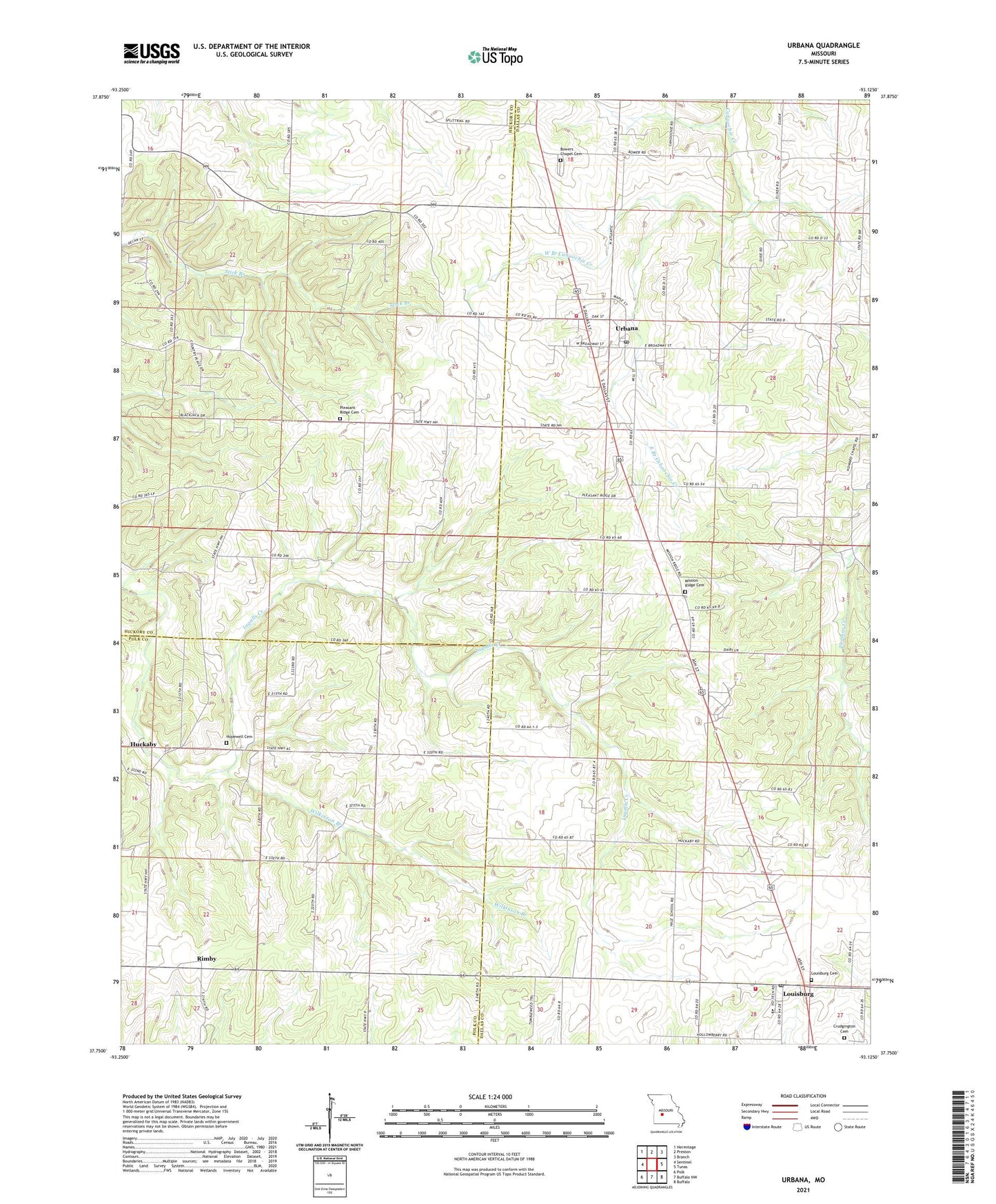
2021 topographic map quadrangle Urbana in the state of Missouri. Scale: 1:24000. Based on the newly updated USGS 7.5' US Topo map series, this map is in the following counties: Dallas, Hickory, Polk. The map contains contour data, water features, and other items you are used to seeing on USGS maps, but also has updated roads and other features. This is the next generation of topographic maps. Printed on high-quality waterproof paper with UV fade-resistant inks.
Quads adjacent to this one:
West: Sentinel
Northwest: Hermitage
North: Preston
Northeast: Branch
East: Tunas
Southeast: Buffalo
South: Buffalo NW
Southwest: Polk
Contains the following named places: Atlas School, Bower Chapel, Bowers Chapel Cemetery, City of Urbana, Cream Ridge School, Crudgington Cemetery, East Branch Cahoochie Creek, Hopewell Cemetery, Hopewell Church, Huckaby, Ingalls, Lone Post School, Louisburg, Louisburg Cemetery, Louisburg Post Office, Louisburg School, Louisburg Volunteer Fire Department Main Station, Mission Ridge Cemetery, Mission Ridge Church, Pleasant Ridge Cemetery, Pleasant Ridge Church, Pleasant Ridge School, Rimby, Star Ridge School, Township of Lincoln, Township of North Green, Urbana, Urbana Post Office, Urbana Rural Fire Department Station 1, Urbana Rural Fire Department Station 2, Urbana School, Victor School, Village of Louisburg, West Branch Cahoochie Creek, Wilkinson Branch, Wilkinson Creek, ZIP Codes: 65685, 65767