MyTopo
Alder Montana US Topo Map
Couldn't load pickup availability
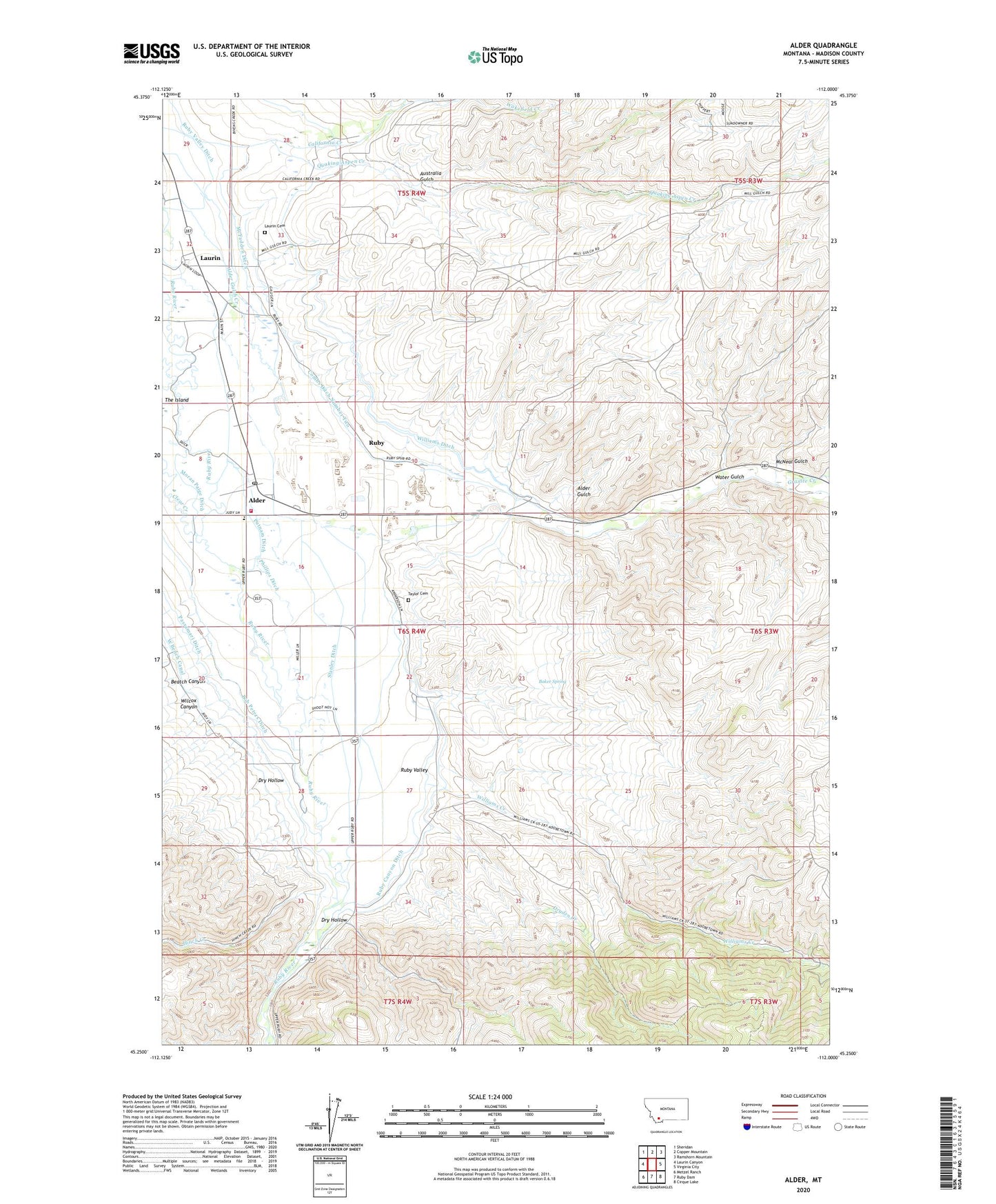
2024 topographic map quadrangle Alder in the state of Montana. Scale: 1:24000. Based on the newly updated USGS 7.5' US Topo map series, this map is in the following counties: Madison. The map contains contour data, water features, and other items you are used to seeing on USGS maps, but also has updated roads and other features. This is the next generation of topographic maps. Printed on high-quality waterproof paper with UV fade-resistant inks.
Quads adjacent to this one:
West: Laurin Canyon
Northwest: Sheridan
North: Copper Mountain
Northeast: Ramshorn Mountain
East: Virginia City
Southeast: Cirque Lake
South: Ruby Dam
Southwest: Metzel Ranch
This map covers the same area as the classic USGS quad with code o45112c1.
Contains the following named places: 05S04W28DDBB01 Well, 06S04W05AACB01 Well, 06S04W10CDCC01 Well, 06S04W15CDDC01 Well, 06S04W28ADDD01 Well, 06S04W28BDAA01 Well, Alder, Alder Census Designated Place, Alder Gulch, Alder KOA Kampground, Alder Post Office, Alder Rest Home, Alder Rural Fire District, Alder School, Australia Gulch, Baker Spring, Beatch Canyon, Bob Peters Ditch, California Ranch, Charlie Ray Mine, Combs Ditch Number Two, Cook Mine, DeHorty Flat, Dry Hollow, Dryden Creek, Geel Mine, Golden Overlook Mine, Grace Community Fellowship Church, Granite Creek, Harris Creek, Hinch Creek, Laurin, Laurin Cemetery, Laurin Post Office, Laurin School, McFadden Ditch, McNeal Gulch, Moran Paige Ditch, NE NE Section 32 Mine, NE Section 31 Mine, NE SW Section 1/Cal Creek Mine, Passamari Ditch, Phillips Ditch, Putnam Ditch, Quaking Aspen Creek, Ruby, Ruby Canyon Ditch, Ruby Post Office, Ruby School, Ruby Valley Historical Marker, Saint Lawrence Mine, Saint Mary of the Assumption Parish, SE Section 1/Cal Creek Mine, Silver Bell Mine, Stanley Ditch, SW Section 31 Mine, Taylor Cemetery, Water Gulch, Wilcox Canyon, Williams Creek, Williams Ditch