MyTopo
Laurin Canyon Montana US Topo Map
Couldn't load pickup availability
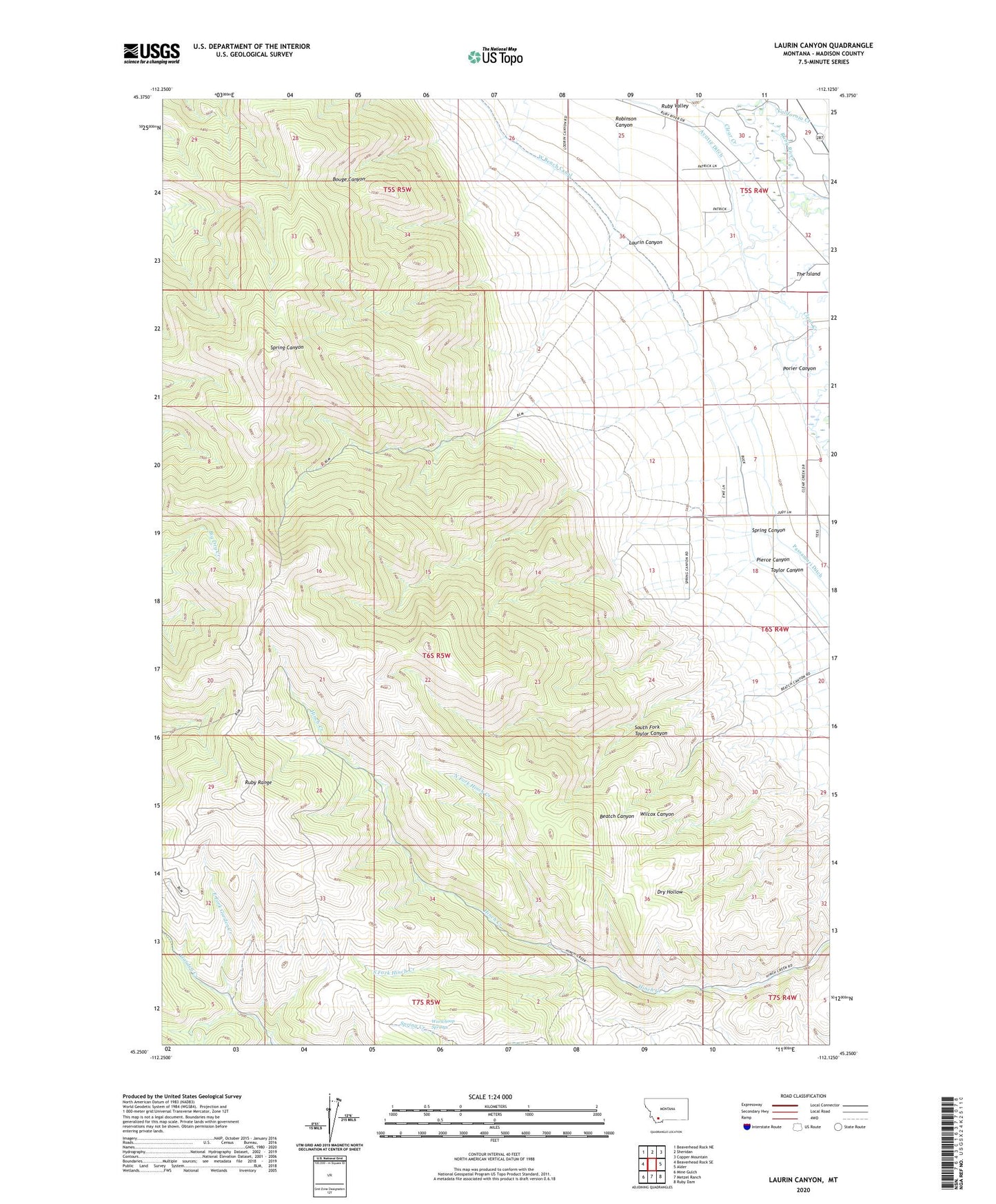
2024 topographic map quadrangle Laurin Canyon in the state of Montana. Scale: 1:24000. Based on the newly updated USGS 7.5' US Topo map series, this map is in the following counties: Madison. The map contains contour data, water features, and other items you are used to seeing on USGS maps, but also has updated roads and other features. This is the next generation of topographic maps. Printed on high-quality waterproof paper with UV fade-resistant inks.
Quads adjacent to this one:
West: Beaverhead Rock SE
Northwest: Beaverhead Rock NE
North: Sheridan
Northeast: Copper Mountain
East: Alder
Southeast: Ruby Dam
South: Metzel Ranch
Southwest: Mine Gulch
This map covers the same area as the classic USGS quad with code o45112c2.
Contains the following named places: 06S04W06ACDA01 Well, 06S04W06DBAB01 Well, Alder Gulch Creek, Ayotte Ditch, California Creek, East Fork Garden Creek, Laurin Canyon, North Fork Hinch Creek, Pierce Canyon, Porier Canyon, Robinson Canyon, South Fork Hinch Creek, South Fork Taylor Canyon, Spring Canyon, Taylor Canyon, The Island, Warwhoop Springs, West Bench Canal