MyTopo
Taylor Hills Montana US Topo Map
Couldn't load pickup availability
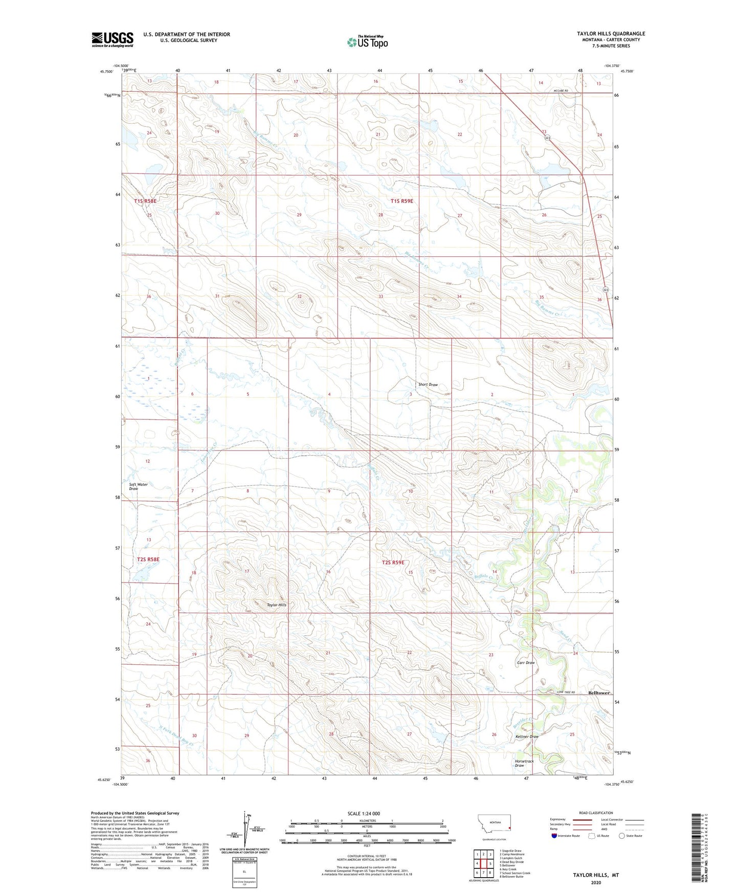
2024 topographic map quadrangle Taylor Hills in the state of Montana. Scale: 1:24000. Based on the newly updated USGS 7.5' US Topo map series, this map is in the following counties: Carter. The map contains contour data, water features, and other items you are used to seeing on USGS maps, but also has updated roads and other features. This is the next generation of topographic maps. Printed on high-quality waterproof paper with UV fade-resistant inks.
Quads adjacent to this one:
West: Dead Boy Divide
Northwest: Stagville Draw
North: Camp Needmore
Northeast: Lampkin Gulch
East: Belltower
Southeast: Belltower Butte
South: School Section Creek
Southwest: Ikey Creek
This map covers the same area as the classic USGS quad with code o45104f4.
Contains the following named places: Belltower, Belltower Post Office, Black Wolfe Number 2 Dam, Black Wolff Number 3 Dam, Buffalo Creek, Carr Draw, Horsetrack Draw, Jackrabbit Dam, Keltner Draw, L Cline Number 1 Dam, Lone Tree Creek, Sand Creek, Soft Water Draw, Taylor Hills