MyTopo
Saint Marys Lake Montana US Topo Map
Couldn't load pickup availability
Also explore the Saint Marys Lake Forest Service Topo of this same quad for updated USFS data
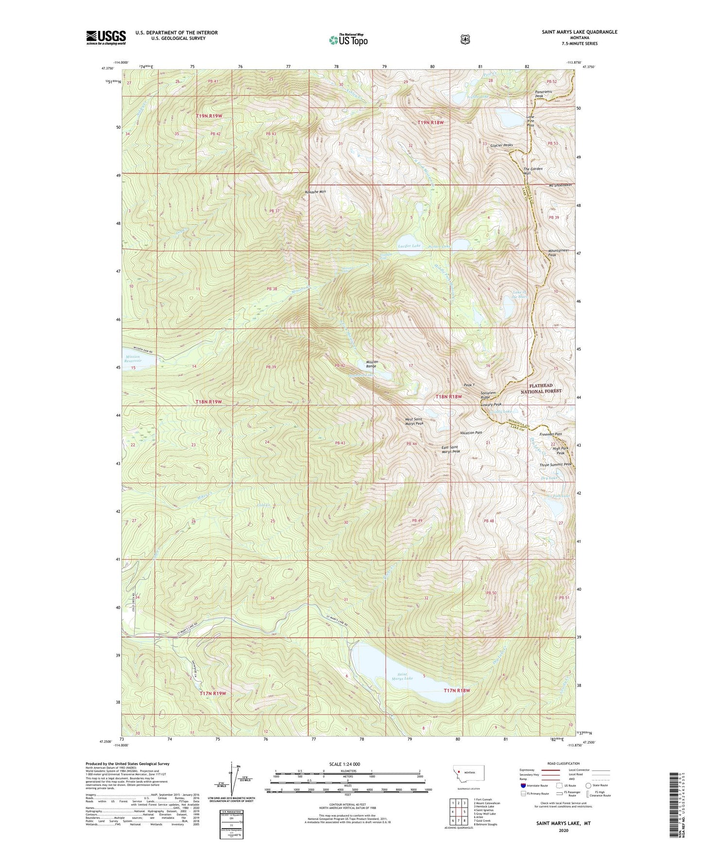
2024 topographic map quadrangle Saint Marys Lake in the state of Montana. Scale: 1:24000. Based on the newly updated USGS 7.5' US Topo map series, this map is in the following counties: Lake, Missoula. The map contains contour data, water features, and other items you are used to seeing on USGS maps, but also has updated roads and other features. This is the next generation of topographic maps. Printed on high-quality waterproof paper with UV fade-resistant inks.
Quads adjacent to this one:
West: Saint Ignatius
Northwest: Fort Connah
North: Mount Calowahcan
Northeast: Hemlock Lake
East: Gray Wolf Lake
Southeast: Belmore Sloughs
South: Gold Creek
Southwest: Arlee
This map covers the same area as the classic USGS quad with code o47113c8.
Contains the following named places: Dry Creek Canal, Dry Lake, Dry Lake Creek, East Saint Marys Peak, Elizabeth Falls, Fissure Glacier, Freeman Pass, Glacier Peaks, Grizzly Lake, High Park Peak, Icefloe Lake, Kakashe Mountain, Lake of the Clouds, Lake of the Stars, Lone Tree Pass, Lowary Peak, Lucifer Lake, Middle Fork Mission Creek, Mission Falls, Mission Falls Campground, Mission Reservoir Campground 2, Mount Shoemaker, Mountaineer Glacier, Mountaineer Peak, No Fish Lake, North Fork Mission Creek, Panoramic Peak, Peak Y, Picture Lake, Power Creek, Saint Marys Lake, Saint Marys Lake Campground, Sonielem Lake, Sonielem Ridge, South Fork Mission Creek, Sunrise Glacier, Tabor Dam, The Garden Wall, Vacation Pass, West Saint Marys Peak