MyTopo
Big Sag Montana US Topo Map
Couldn't load pickup availability
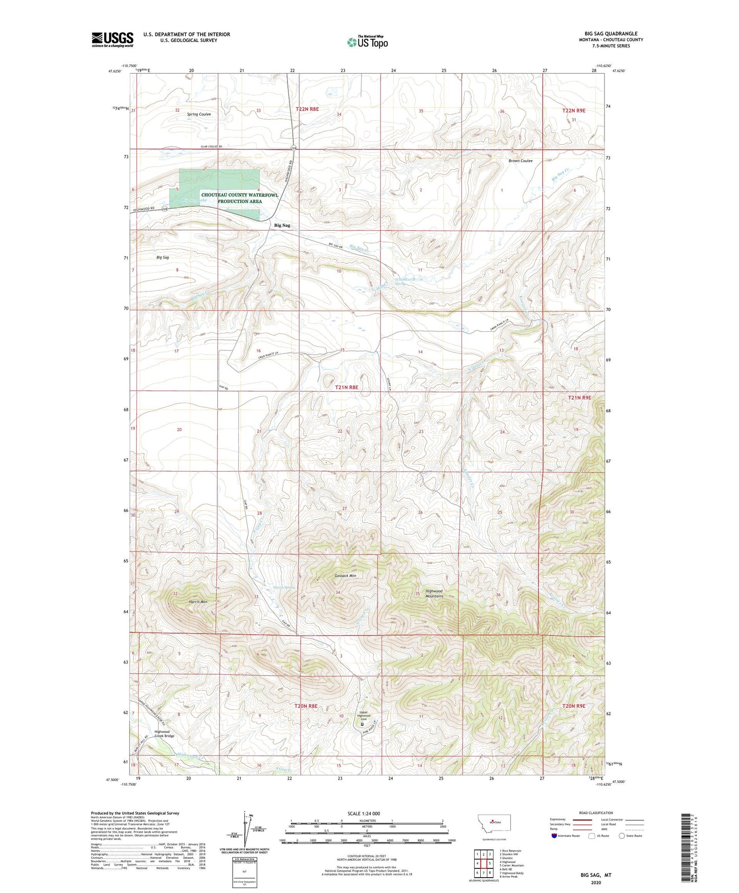
2024 topographic map quadrangle Big Sag in the state of Montana. Scale: 1:24000. Based on the newly updated USGS 7.5' US Topo map series, this map is in the following counties: Chouteau. The map contains contour data, water features, and other items you are used to seeing on USGS maps, but also has updated roads and other features. This is the next generation of topographic maps. Printed on high-quality waterproof paper with UV fade-resistant inks.
Quads adjacent to this one:
West: Highwood
Northwest: Rice Reservoir
North: Shonkin NW
Northeast: Shonkin
East: Carter Mountain
Southeast: Arrow Peak
South: Highwood Baldy
Southwest: Belt NE
This map covers the same area as the classic USGS quad with code o47110e6.
Contains the following named places: 21N08E11CB__01 Spring, 59450, Big Sag, Big Sag Lake, Big Sag School, Brown Coulee, Gossack Mountain, Greeley Elevator, Harris Mountain, Harris Spring, Highwood Creek Bridge, Hop Creek, Keaster Creek, North Gap Creek, Shaw Creek, Upper Highwood Cemetery, Upper Highwood Church