MyTopo
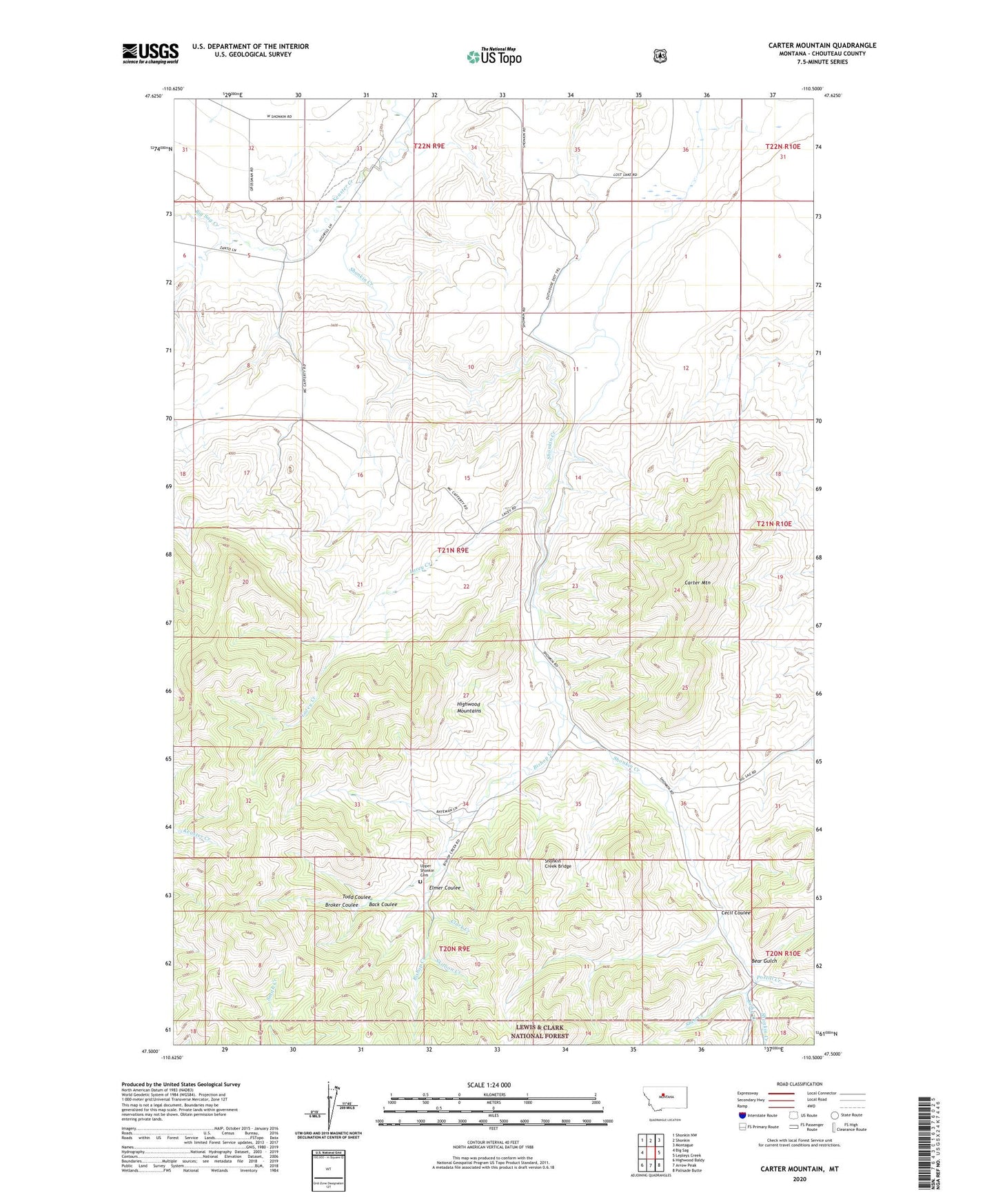
Carter Mountain Montana US Topo Map
Couldn't load pickup availability
Also explore the Carter Mountain Forest Service Topo of this same quad for updated USFS data
2024 topographic map quadrangle Carter Mountain in the state of Montana. Scale: 1:24000. Based on the newly updated USGS 7.5' US Topo map series, this map is in the following counties: Chouteau. The map contains contour data, water features, and other items you are used to seeing on USGS maps, but also has updated roads and other features. This is the next generation of topographic maps. Printed on high-quality waterproof paper with UV fade-resistant inks.
Quads adjacent to this one:
West: Big Sag
Northwest: Shonkin NW
North: Shonkin
Northeast: Montague
East: Lepleys Creek
Southeast: Palisade Butte
South: Arrow Peak
Southwest: Highwood Baldy
This map covers the same area as the classic USGS quad with code o47110e5.
Contains the following named places: Back Coulee, Bear Gulch, Big Sag Creek, Bishop Creek, Broker Coulee, Carter Mountain, Cecil Coulee, Clark Creek, Elmer Coulee, Kirby Creek, Lacey Creek, Postill Creek, Shea Creek, Shonkin Cow Camp, Shonkin Creek Bridge, Skillion Creek, Todd Coulee, Upper Shonkin Cemetery