MyTopo
Noxon Montana US Topo Map
Couldn't load pickup availability
Also explore the Noxon Forest Service Topo of this same quad for updated USFS data
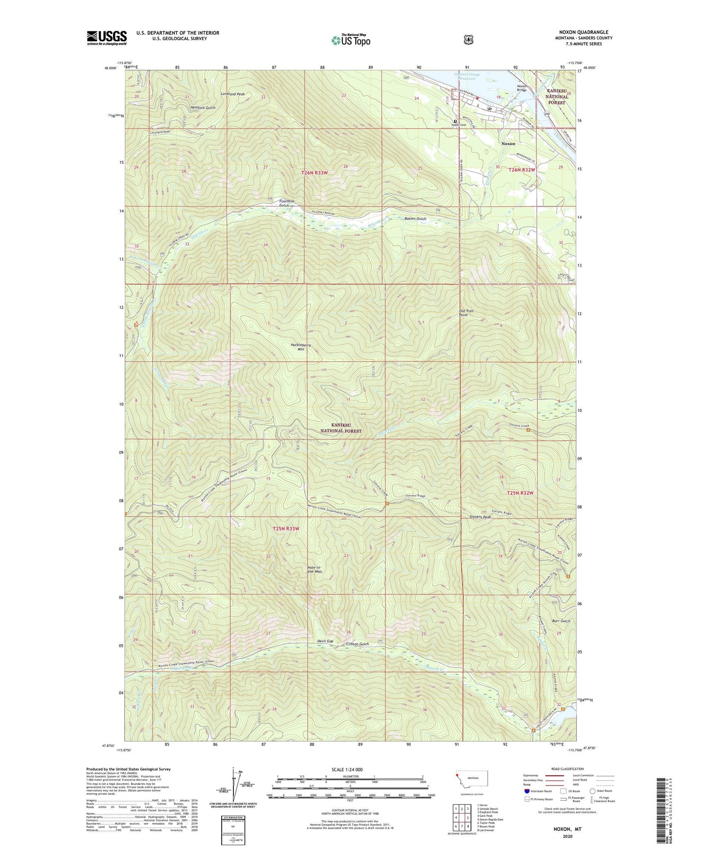
2024 topographic map quadrangle Noxon in the state of Montana. Scale: 1:24000. Based on the newly updated USGS 7.5' US Topo map series, this map is in the following counties: Sanders. The map contains contour data, water features, and other items you are used to seeing on USGS maps, but also has updated roads and other features. This is the next generation of topographic maps. Printed on high-quality waterproof paper with UV fade-resistant inks.
Quads adjacent to this one:
West: Gem Peak
Northwest: Heron
North: Smeads Bench
Northeast: Elephant Peak
East: Noxon Rapids Dam
Southeast: Larchwood
South: Bloom Peak
Southwest: Taylor Peak
This map covers the same area as the classic USGS quad with code o47115h7.
Contains the following named places: 26N32W19CDDB01 Well, 26N32W30BABA01 Well, 26N33W25ADDA01 Well, Baxter Gulch, Clinton Gulch, Devil Gap, Fir Creek, Fourmile Gulch, Government Creek, Hole-in-the-Wall, Huckleberry Mountain, Huckleberry Mountain Trail, Kismet Creek, Loveland Peak, Marten Creek, Noxon, Noxon Bridge, Noxon Cemetery, Noxon Census Designated Place, Noxon Clinic, Noxon Community Ambulance, Noxon Community Museum, Noxon Methodist Church, Noxon Post Office, Noxon Public Schools, Noxon Rural Fire District, Old Trail Point, Pilgrim Creek, Rabbit Run, South Fork Marten Creek, South Fork Pilgrim Creek, Steep Creek, Stevens Creek Trail, Stevens Peak, Stevens Ridge Trail, Telegraph Creek, Weares Spur, West Fork Pilgrim Creek, White Star Mine