MyTopo
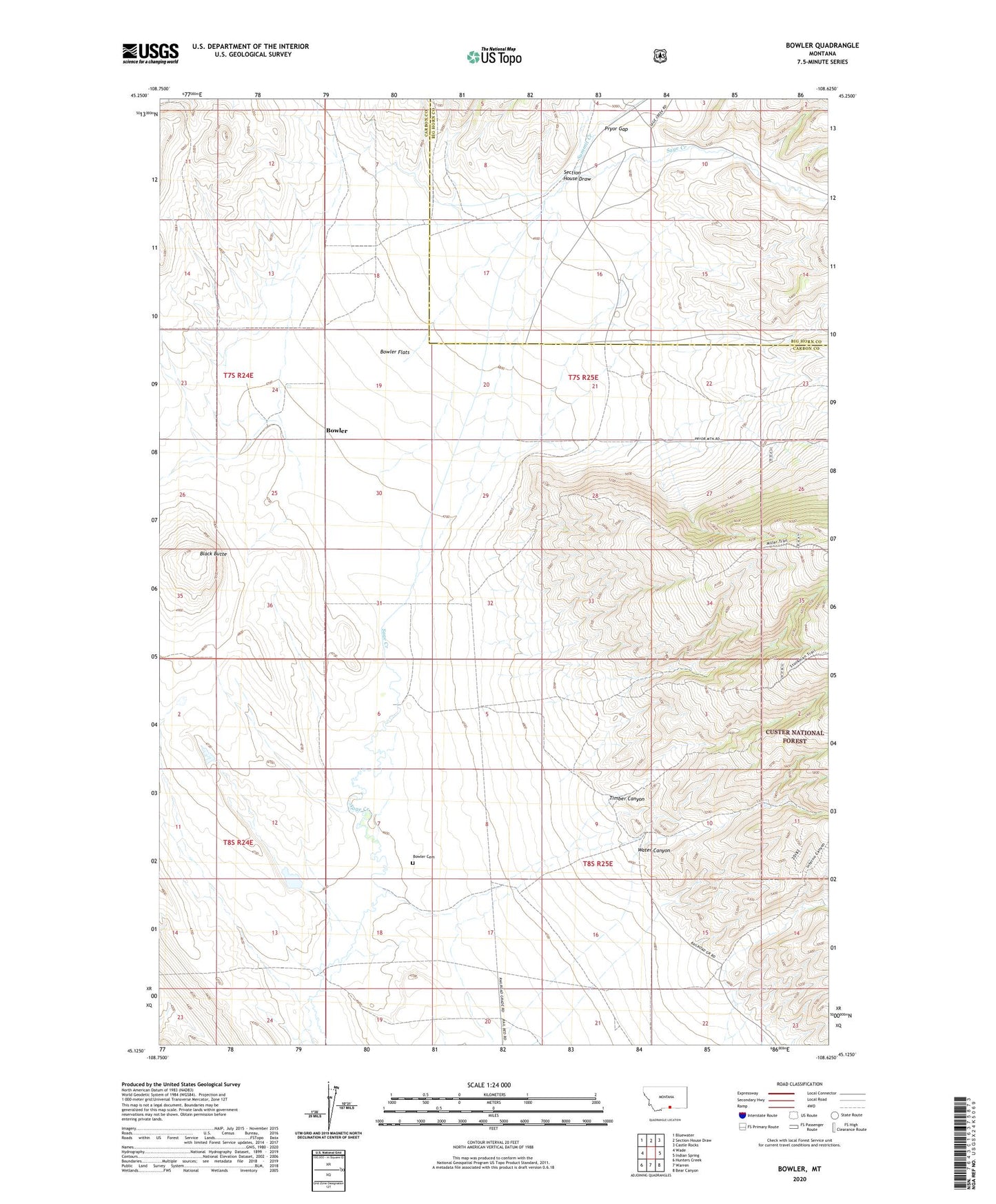
Bowler Montana US Topo Map
Couldn't load pickup availability
Also explore the Bowler Forest Service Topo of this same quad for updated USFS data
2024 topographic map quadrangle Bowler in the state of Montana. Scale: 1:24000. Based on the newly updated USGS 7.5' US Topo map series, this map is in the following counties: Carbon, Big Horn. The map contains contour data, water features, and other items you are used to seeing on USGS maps, but also has updated roads and other features. This is the next generation of topographic maps. Printed on high-quality waterproof paper with UV fade-resistant inks.
Quads adjacent to this one:
West: Wade
Northwest: Bluewater
North: Section House Draw
Northeast: Castle Rocks
East: Indian Spring
Southeast: Bear Canyon
South: Warren
Southwest: Hunters Creek
This map covers the same area as the classic USGS quad with code o45108b6.
Contains the following named places: 07S24E25AAAA01 Well, 07S25E23CABB01 Well, 07S25E28AAA_01 Well, 08S25E04CCC_01 Well, 08S25E06DCDC01 Well, Black Butte, Bowler, Bowler Cemetery, Bowler Flats, Bowler Post Office, Bowler School, East Carbon Division, Marlew Number 2 Dam, Miller Trail, Section House Draw, Summit Creek, Timber Canyon, Water Canyon