MyTopo
Wade Montana US Topo Map
Couldn't load pickup availability
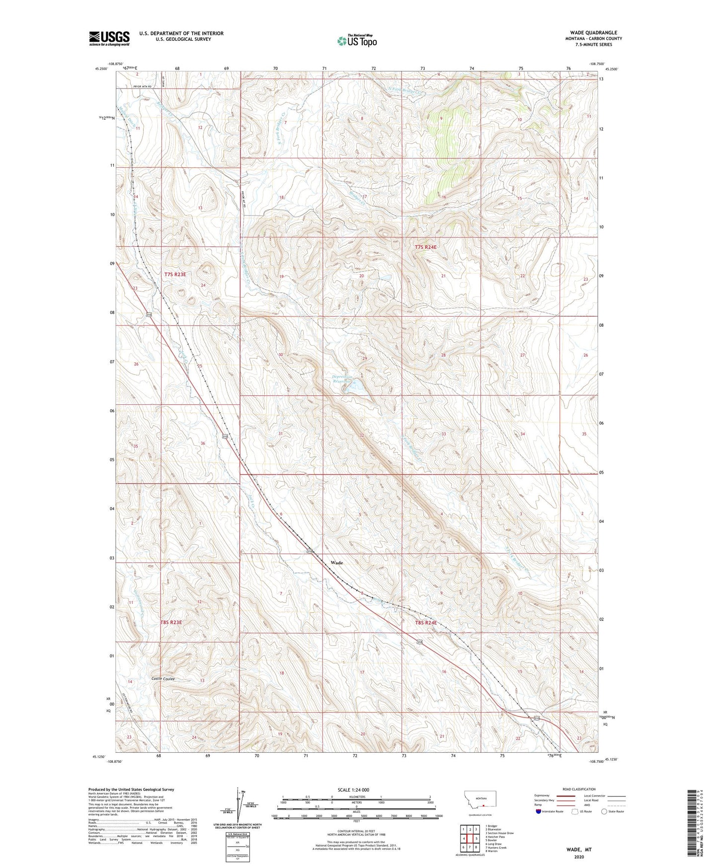
2024 topographic map quadrangle Wade in the state of Montana. Scale: 1:24000. Based on the newly updated USGS 7.5' US Topo map series, this map is in the following counties: Carbon. The map contains contour data, water features, and other items you are used to seeing on USGS maps, but also has updated roads and other features. This is the next generation of topographic maps. Printed on high-quality waterproof paper with UV fade-resistant inks.
Quads adjacent to this one:
West: Hatcher Pass
Northwest: Bridger
North: Bluewater
Northeast: Section House Draw
East: Bowler
Southeast: Warren
South: Hunters Creek
Southwest: Long Draw
This map covers the same area as the classic USGS quad with code o45108b7.
Contains the following named places: 07S24E20ADCD01 Well, 08S23E11DCAD01 Well, 59014, Baker Cabin, Castle Coulee, Cherry Creek, Depression Detention Dam, Depression Reservoir, Musgrave Post Office, North Fork Bridger Creek, Parker Cabin, South Fork Bridger Creek, Tyndell, Wade, Wade School