MyTopo
Warren Montana US Topo Map
Couldn't load pickup availability
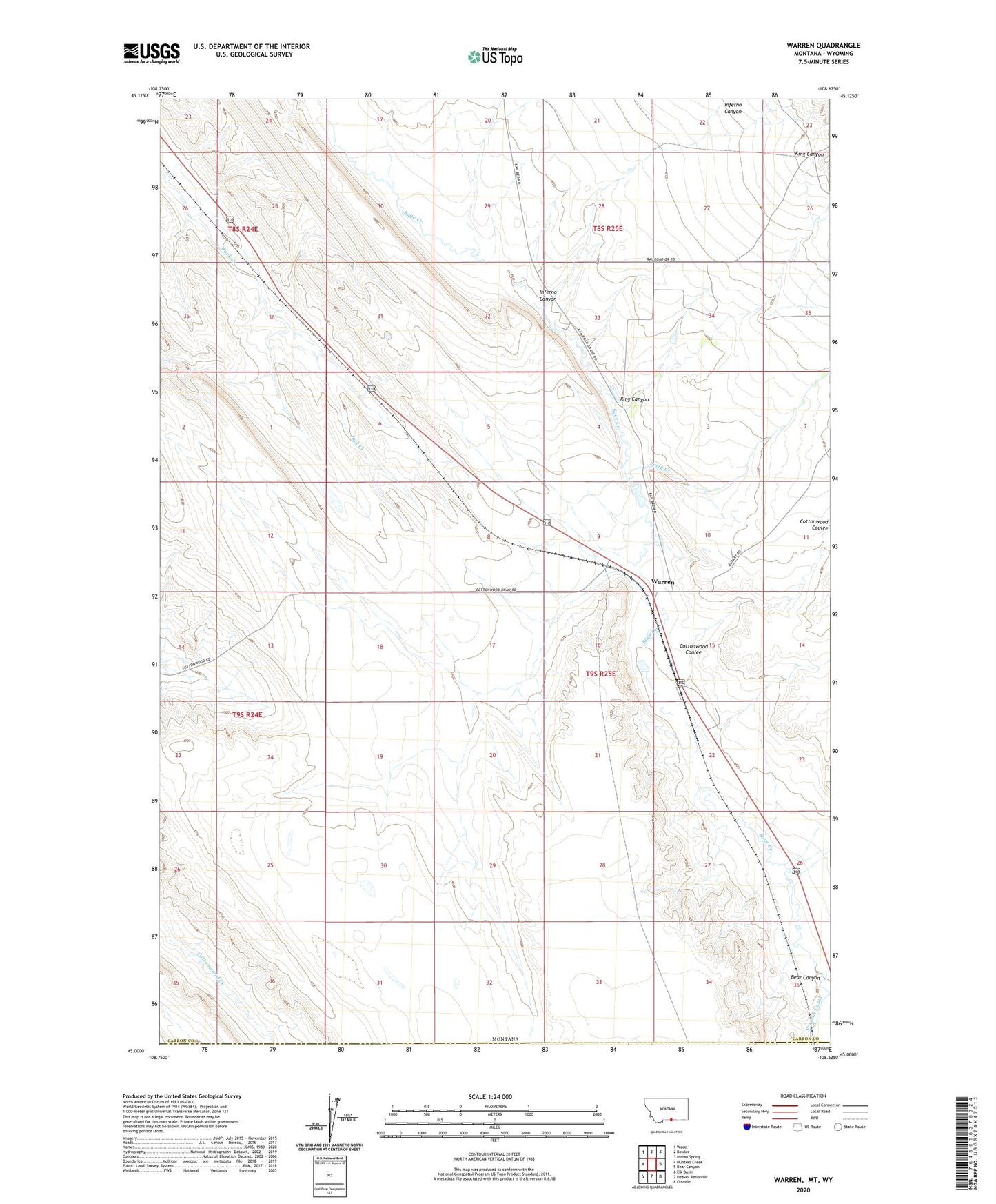
2024 topographic map quadrangle Warren in the state of Montana. Scale: 1:24000. Based on the newly updated USGS 7.5' US Topo map series, this map is in the following counties: Carbon, Park. The map contains contour data, water features, and other items you are used to seeing on USGS maps, but also has updated roads and other features. This is the next generation of topographic maps. Printed on high-quality waterproof paper with UV fade-resistant inks.
Quads adjacent to this one:
West: Hunters Creek
Northwest: Wade
North: Bowler
Northeast: Indian Spring
East: Bear Canyon
Southeast: Frannie
South: Deaver Reservoir
Southwest: Elk Basin
Contains the following named places: 09S25E23ABCD01 Well, 09S25E33DDDD01 Well, 09S25E34CCCC01 Well, Adams Reservoir, Bean Post Office, Bear Canyon, Cottonwood Coulee, Drum Number 2 Dam, Duff, Inferno Canyon, King Canyon, Piney Creek, Scribner Junction, Warren, Warren Post Office, Warren School