MyTopo
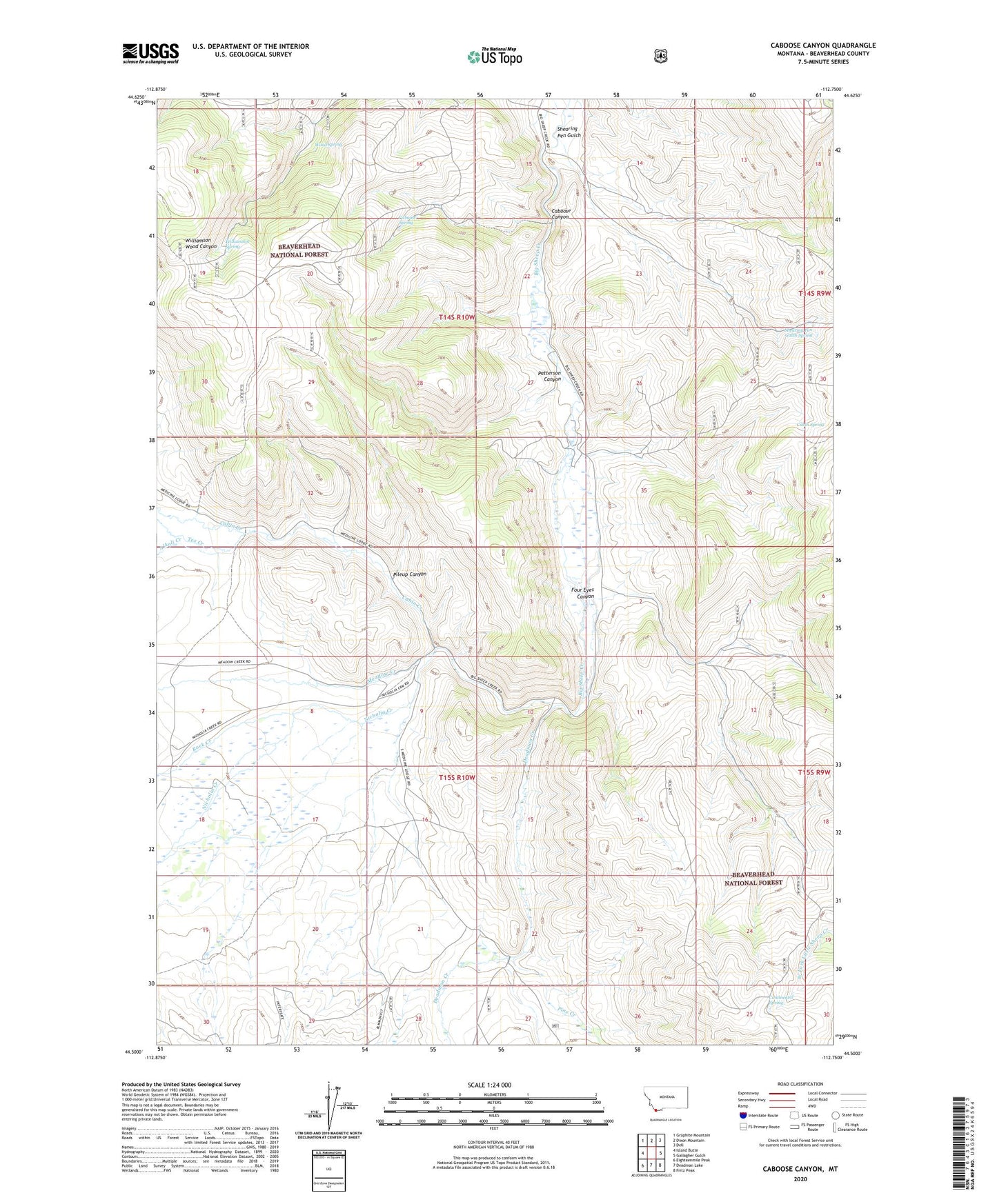
Caboose Canyon Montana US Topo Map
Couldn't load pickup availability
Also explore the Caboose Canyon Forest Service Topo of this same quad for updated USFS data
2024 topographic map quadrangle Caboose Canyon in the state of Montana. Scale: 1:24000. Based on the newly updated USGS 7.5' US Topo map series, this map is in the following counties: Beaverhead. The map contains contour data, water features, and other items you are used to seeing on USGS maps, but also has updated roads and other features. This is the next generation of topographic maps. Printed on high-quality waterproof paper with UV fade-resistant inks.
Quads adjacent to this one:
West: Island Butte
Northwest: Graphite Mountain
North: Dixon Mountain
Northeast: Dell
East: Gallagher Gulch
Southeast: Fritz Peak
South: Deadman Lake
Southwest: Eighteenmile Peak
This map covers the same area as the classic USGS quad with code o44112e7.
Contains the following named places: Alkali Creek, Cabin Creek, Cabin Spring, Caboose Canyon, Caboose Spring, Continental Spring, Deadman Creek, Deadman Creek Station, Four Eyes Canyon, Meadow Creek, Nicholia Creek, Patterson Canyon, Peterson Ranch, Pileup Canyon, Pine Creek, Rock Creek, SE SE Section 16 Mine, Shearing Pen Gulch, Shearing Pen Gulch Spring, Sun Number 12 Mine, Tex Creek, Williamson Spring, Wood Spring