MyTopo
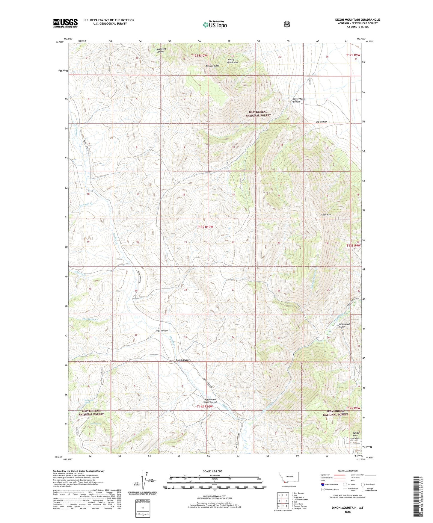
Dixon Mountain Montana US Topo Map
Couldn't load pickup availability
Also explore the Dixon Mountain Forest Service Topo of this same quad for updated USFS data
2024 topographic map quadrangle Dixon Mountain in the state of Montana. Scale: 1:24000. Based on the newly updated USGS 7.5' US Topo map series, this map is in the following counties: Beaverhead. The map contains contour data, water features, and other items you are used to seeing on USGS maps, but also has updated roads and other features. This is the next generation of topographic maps. Printed on high-quality waterproof paper with UV fade-resistant inks.
Quads adjacent to this one:
West: Graphite Mountain
Northwest: Deer Canyon
North: Kidd
Northeast: Briggs Ranch
East: Dell
Southeast: Gallagher Gulch
South: Caboose Canyon
Southwest: Island Butte
This map covers the same area as the classic USGS quad with code o44112f7.
Contains the following named places: Carr Canyon, Deadwood Gulch, Dixon Mountain, Dry Canyon, Harkness Spring, Hidden Pasture Creek, Hidden Pasture Trail, Johnson Creek, Little Water Canyon, Little Water Canyon Mine, McNinch Creek, Muddy Creek, Rock Canyon, Rock Spring, Sourdough Creek, Tendoy Mountains, Thompson Creek, Timber Butte, Trail Hollow, White Pine Ridge, Williamson Wood Canyon, Wilson Creek, ZIP Code: 59724