MyTopo
Christensen Ranch Montana US Topo Map
Couldn't load pickup availability
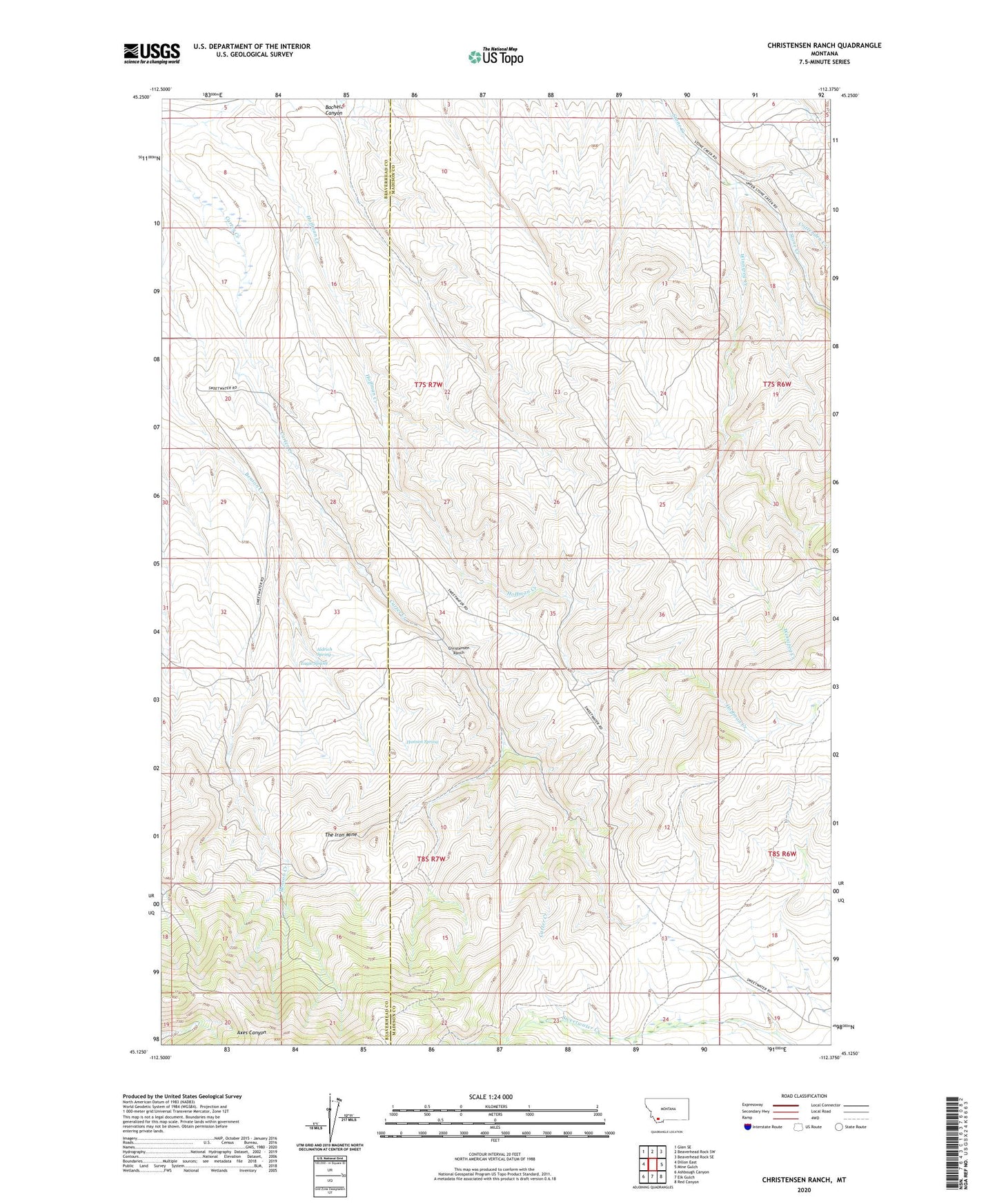
2024 topographic map quadrangle Christensen Ranch in the state of Montana. Scale: 1:24000. Based on the newly updated USGS 7.5' US Topo map series, this map is in the following counties: Madison, Beaverhead. The map contains contour data, water features, and other items you are used to seeing on USGS maps, but also has updated roads and other features. This is the next generation of topographic maps. Printed on high-quality waterproof paper with UV fade-resistant inks.
Quads adjacent to this one:
West: Dillon East
Northwest: Glen SE
North: Beaverhead Rock SW
Northeast: Beaverhead Rock SE
East: Mine Gulch
Southeast: Red Canyon
South: Elk Gulch
Southwest: Ashbough Canyon
This map covers the same area as the classic USGS quad with code o45112b4.
Contains the following named places: 07S06W07BBAD01 Well, Abenson Dam, Aldrich Spring, Bachelor Canyon, Benson Ranch, Bishop Place, Christensen Ranch, Crittenden Creek, Eagle Spring, Guidici Cowcamp, Guntner Place, Hanson Spring, Hoffman Place, Hoffman Place Mine, Holden Place, NW NE Section 12 Mine, Regal Mine, SE NE Section 13 Mine, Sorensen Ranch, The Iron Mine, Winnipeg Creek