MyTopo
Boyd Montana US Topo Map
Couldn't load pickup availability
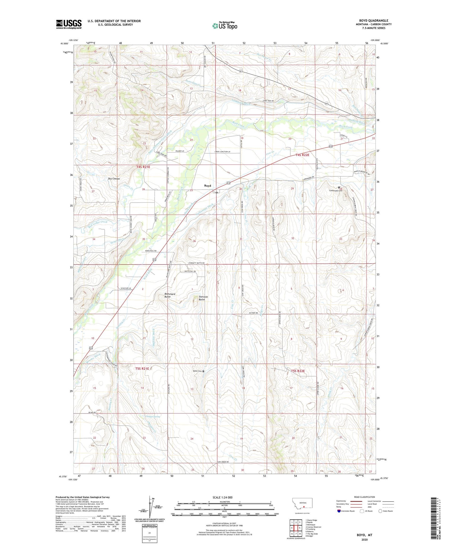
2024 topographic map quadrangle Boyd in the state of Montana. Scale: 1:24000. Based on the newly updated USGS 7.5' US Topo map series, this map is in the following counties: Carbon. The map contains contour data, water features, and other items you are used to seeing on USGS maps, but also has updated roads and other features. This is the next generation of topographic maps. Printed on high-quality waterproof paper with UV fade-resistant inks.
Quads adjacent to this one:
West: Cooney Reservoir
Northwest: Shane Ridge
North: Rapids
Northeast: Montaqua
East: Fromberg
Southeast: Bridger
South: The Big Slide
Southwest: Roberts
This map covers the same area as the classic USGS quad with code o45109d1.
Contains the following named places: 04S22E17CBBA01 Well, 04S22E18ADCA01 Well, 04S22E28BBDD01 Well, 05S21E01CDAA01 Well, 05S21E14BBCA01 Well, 59013, Bailey School, Beltz Cemetery, Black Diamond Fishing Access Site, Blanchard Butte, Boyd, Boyd Census Designated Place, Boyd Methodist Episcopal Church, Boyd Post Office, Boyd School, Carbon, Carbonado Cemetery, Carbonado Ditch, Carbonado Mine, Carbonado Post Office, Carbonado School, Chappel Creek, Chappel Spring, Cow Creek, Dry Coulee, Grove Creek, Gruel Ditch, Heifer Creek, Highline Ditch, Hoyle Ditch, Leimback Ditch, Lone Tree Creek, Lone Tree School, Red Lodge Creek, Rooney Ditch, Sabo-Johnson-Curry Ditch, Selmes School, Stanley Creek, Stormitt Butte, Victory School, Wallila Coulee, Ward Ditch