MyTopo
Roberts Montana US Topo Map
Couldn't load pickup availability
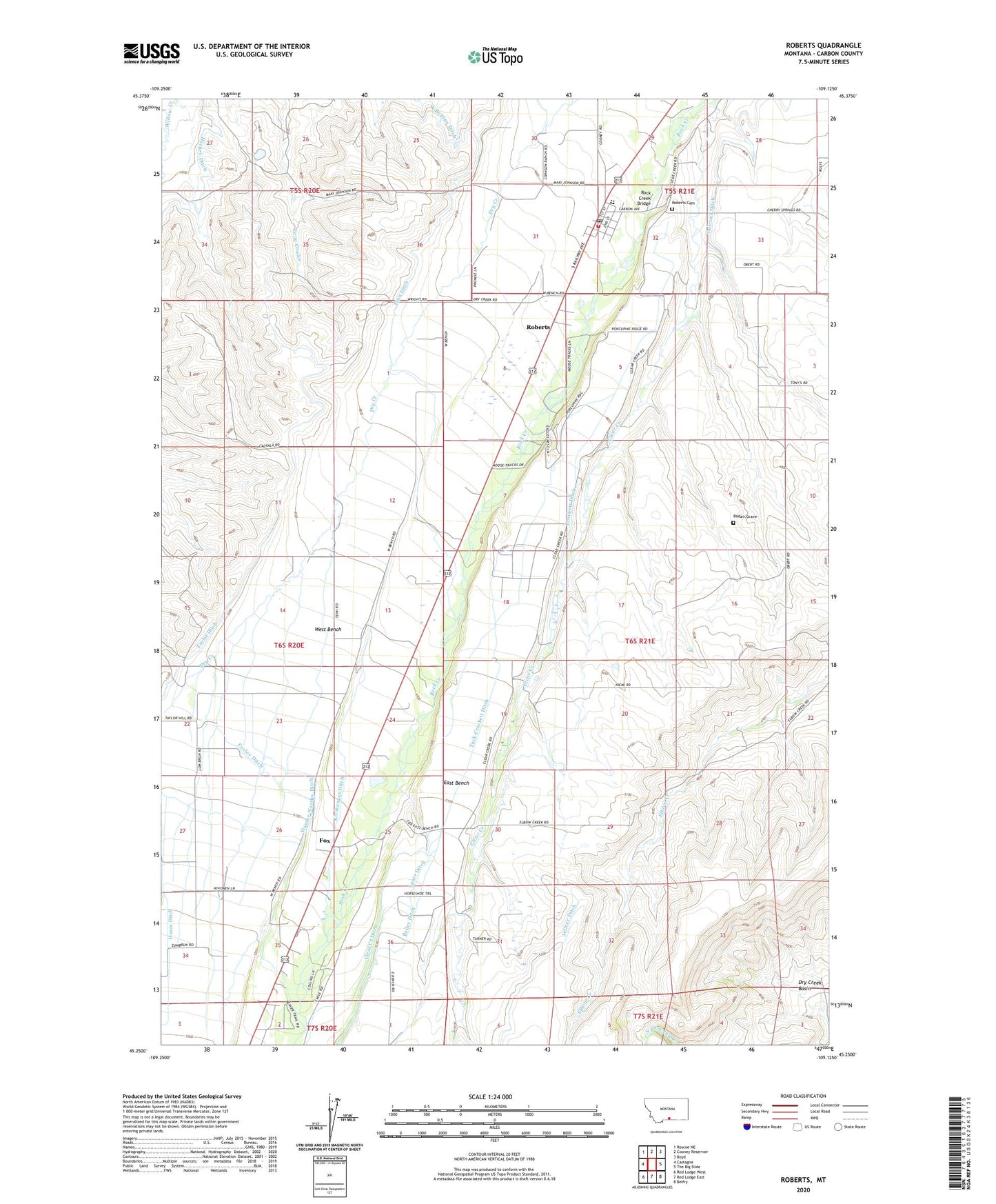
2024 topographic map quadrangle Roberts in the state of Montana. Scale: 1:24000. Based on the newly updated USGS 7.5' US Topo map series, this map is in the following counties: Carbon. The map contains contour data, water features, and other items you are used to seeing on USGS maps, but also has updated roads and other features. This is the next generation of topographic maps. Printed on high-quality waterproof paper with UV fade-resistant inks.
Quads adjacent to this one:
West: Castagne
Northwest: Roscoe NE
North: Cooney Reservoir
Northeast: Boyd
East: The Big Slide
Southeast: Belfry
South: Red Lodge East
Southwest: Red Lodge West
This map covers the same area as the classic USGS quad with code o45109c2.
Contains the following named places: 05S21E29DBCB01 Well, Bailey Ditch, Beartooth Grain and Feed Elevator, Beaver Lodge Fishing Access Site, Bodair Grave, Bull Springs Fishing Access Site, Clear Creek Ditch, Coulee Creek, Crockett Ditch, DeVries Ditch, Dry Creek Basin, East Bench, Feeley Ditch, Finn Ditch, Finnish Hall, Fox, Fox Census Designated Place, Fox School, Harney Ditch, Hunter-Northy Ditch, Jeffrey Ditch, Kivikangas Ditch, Plainview School, Reserve, Roberts, Roberts Cemetery, Roberts Census Designated Place, Roberts Post Office, Roberts Rural Fire District 6, Roberts School, Roberts United Methodist Church, Rock Creek Bridge, Saint Thomas Church, Sigel Farm, Sparr Ditch, Tuck-Crockett Ditch, Water Birch Fishing Access Site, Wentworth Ditch, West Bench