MyTopo
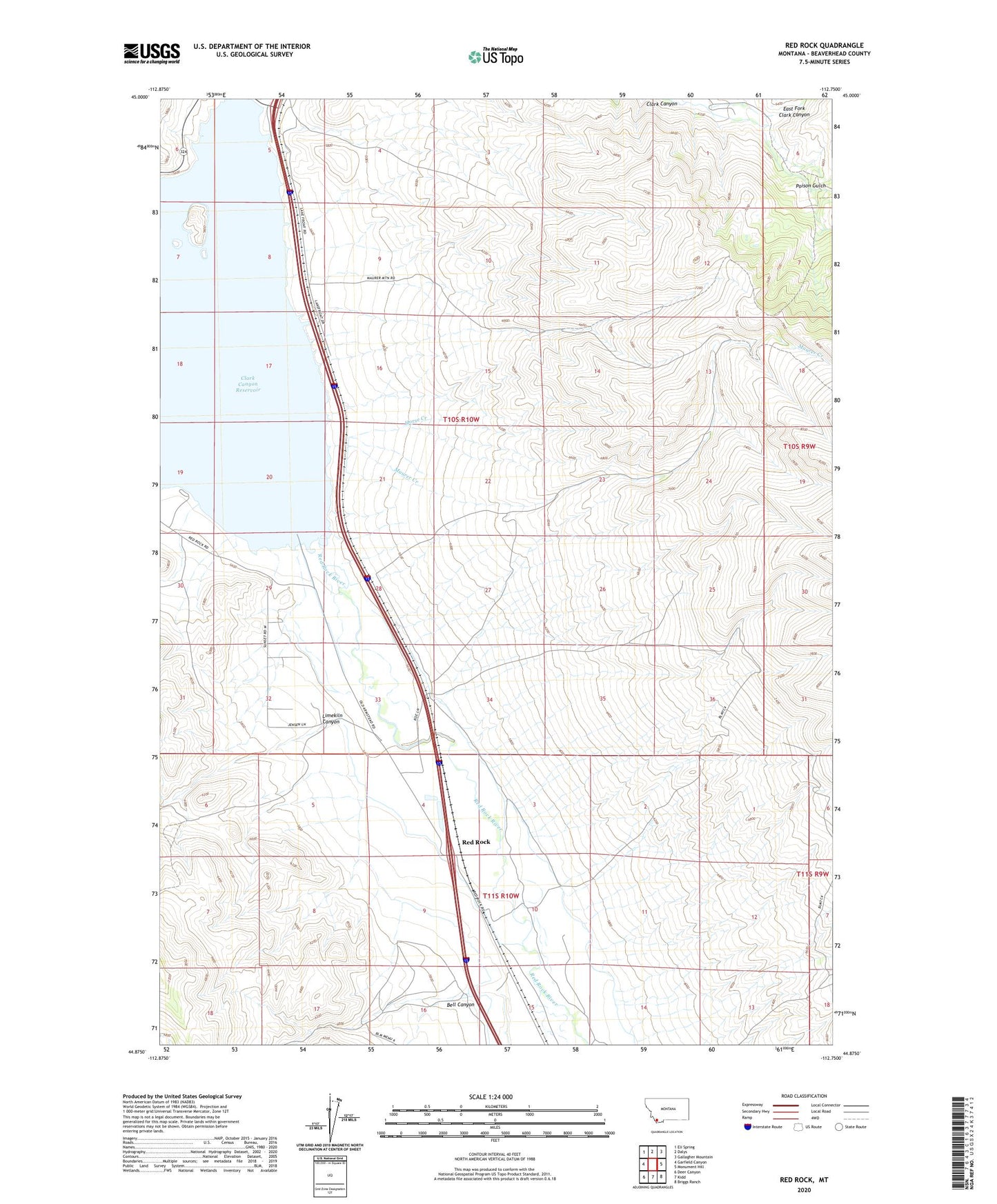
Red Rock Montana US Topo Map
Couldn't load pickup availability
2024 topographic map quadrangle Red Rock in the state of Montana. Scale: 1:24000. Based on the newly updated USGS 7.5' US Topo map series, this map is in the following counties: Beaverhead. The map contains contour data, water features, and other items you are used to seeing on USGS maps, but also has updated roads and other features. This is the next generation of topographic maps. Printed on high-quality waterproof paper with UV fade-resistant inks.
Quads adjacent to this one:
West: Garfield Canyon
Northwest: Eli Spring
North: Dalys
Northeast: Gallagher Mountain
East: Monument Hill
Southeast: Briggs Ranch
South: Kidd
Southwest: Deer Canyon
This map covers the same area as the classic USGS quad with code o44112h7.
Contains the following named places: 10S10W29DCCC01 Well, Armstead, Armstead Post Office, Armstead School, Beaverhead Campground, Bell Canyon, Camp Fortunate, Camp Fortunate Historical Marker, Clark Canyon Dam, Clark Canyon Reservoir, East Fork Clark Canyon, Fishing Access Campground, Horse Creek, Limekiln Canyon, Lonetree Campground, Maurer Creek, Poison Gulch, Red Rock, Red Rock Golf Course and RV Park, Red Rock Post Office, Red Rock River, Redrock School