MyTopo
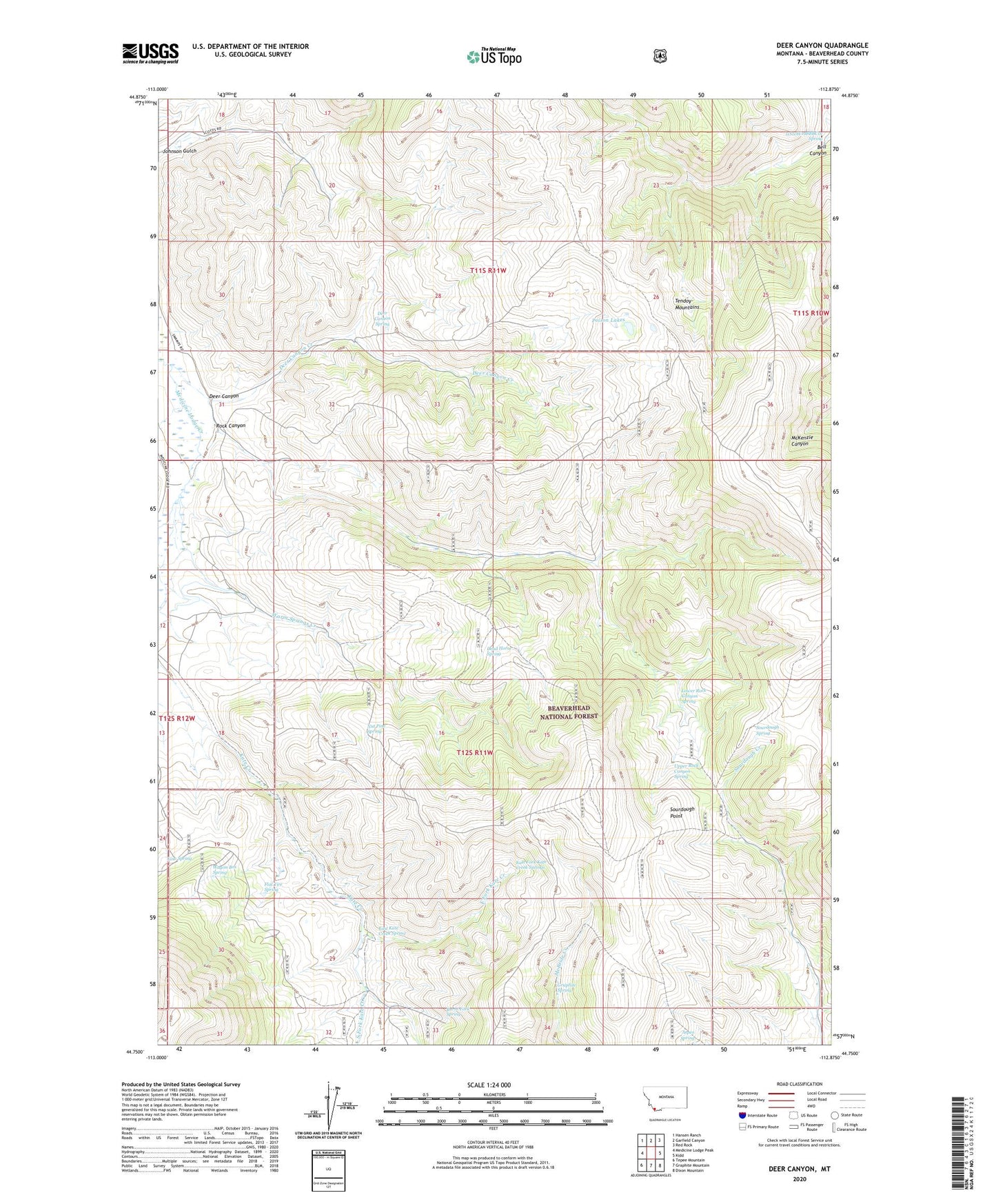
Deer Canyon Montana US Topo Map
Couldn't load pickup availability
Also explore the Deer Canyon Forest Service Topo of this same quad for updated USFS data
2024 topographic map quadrangle Deer Canyon in the state of Montana. Scale: 1:24000. Based on the newly updated USGS 7.5' US Topo map series, this map is in the following counties: Beaverhead. The map contains contour data, water features, and other items you are used to seeing on USGS maps, but also has updated roads and other features. This is the next generation of topographic maps. Printed on high-quality waterproof paper with UV fade-resistant inks.
Quads adjacent to this one:
West: Medicine Lodge Peak
Northwest: Hansen Ranch
North: Garfield Canyon
Northeast: Red Rock
East: Kidd
Southeast: Dixon Mountain
South: Graphite Mountain
Southwest: Tepee Mountain
This map covers the same area as the classic USGS quad with code o44112g8.
Contains the following named places: 11S10W19BBBC01 Spring, Anderson Mine, Aspen Spring, Burnt Fork Spring, Dead Horse Spring, Deer Canyon, Deer Canyon Creek, Deer Canyon Spring, East Fork Kate Creek, East Fork Kate Creek Springs, East Kate Creek Spring, Flat Tire Spring, Graphite Spring, Johnson Gulch, Line Spring, Lower Rock Canyon Spring, McBride Creek Mine, North Fork Deer Canyon Creek, Nut Pine Spring, Poison Lakes, Rock Canyon, Sourdough Point, Sourdough Spring, South Fork Kate Creek, Upper Rock Canyon Spring, Wagon Box Spring, Warm Springs Creek