MyTopo
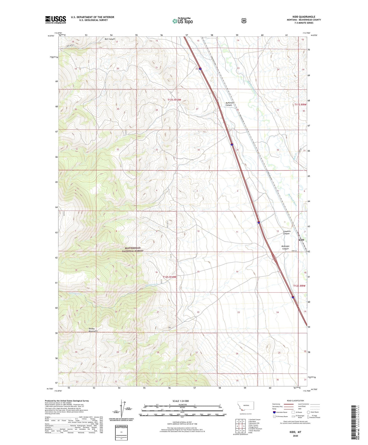
Kidd Montana US Topo Map
Couldn't load pickup availability
Also explore the Kidd Forest Service Topo of this same quad for updated USFS data
2024 topographic map quadrangle Kidd in the state of Montana. Scale: 1:24000. Based on the newly updated USGS 7.5' US Topo map series, this map is in the following counties: Beaverhead. The map contains contour data, water features, and other items you are used to seeing on USGS maps, but also has updated roads and other features. This is the next generation of topographic maps. Printed on high-quality waterproof paper with UV fade-resistant inks.
Quads adjacent to this one:
West: Deer Canyon
Northwest: Garfield Canyon
North: Red Rock
Northeast: Monument Hill
East: Briggs Ranch
Southeast: Dell
South: Dixon Mountain
Southwest: Graphite Mountain
This map covers the same area as the classic USGS quad with code o44112g7.
Contains the following named places: 11S10W26BBCC01 Well, 11S10W27ADAC01 Well, 11S10W34CCAC01 Well, 12S10W22CADA01 Well, Buck Creek, Dell - Red Rock Rest Area, Kelmbeck Creek, Kidd, Kidd Pit Mine, Kidd School, Limekiln Canyon, Limekiln Canyon Creek Mine, McKenzie Canyon, McKnight Canyon, Old Trail to the Gold Diggins Historical Marker, Willow Spring