MyTopo
Eightmile Creek Montana US Topo Map
Couldn't load pickup availability
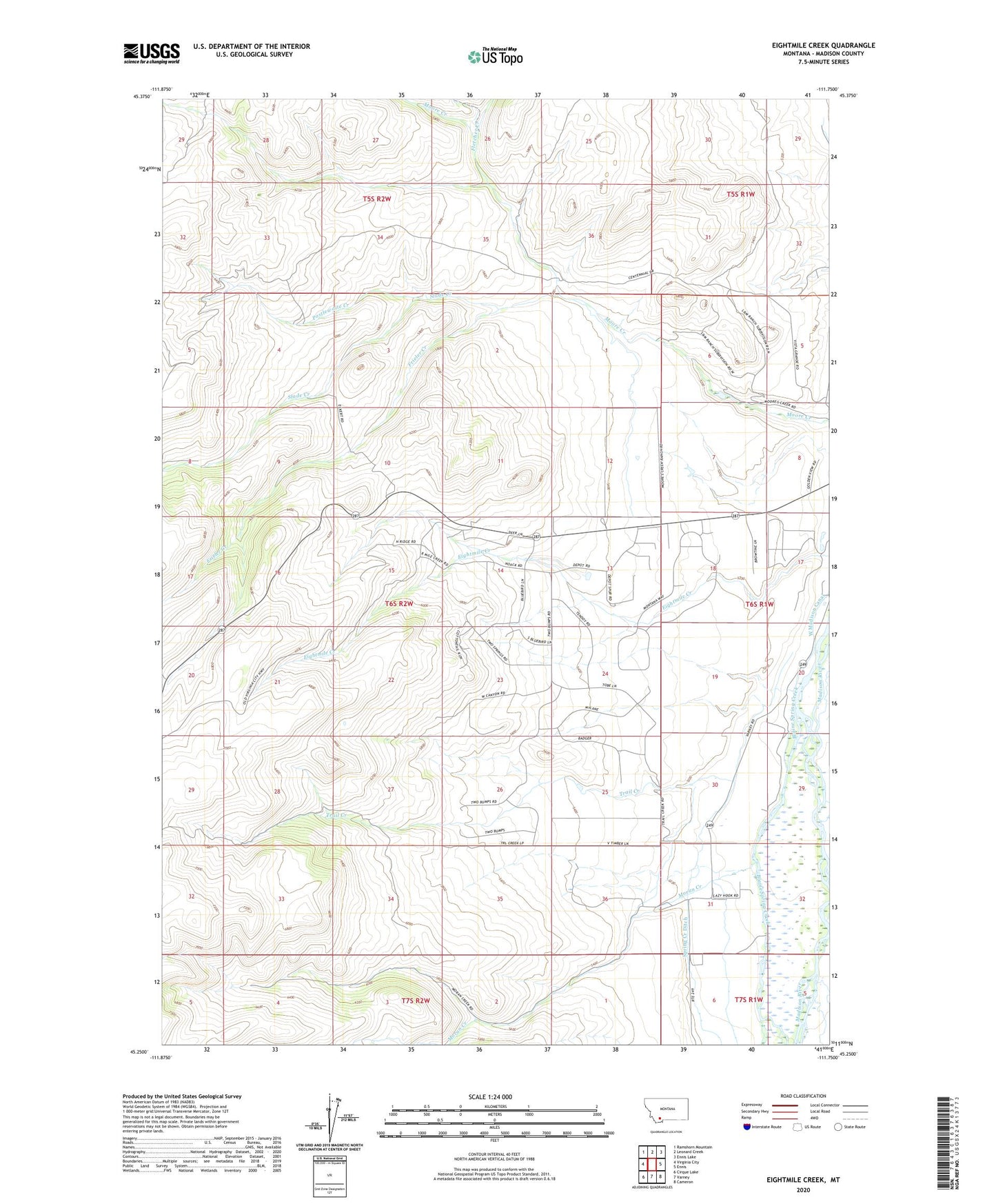
2024 topographic map quadrangle Eightmile Creek in the state of Montana. Scale: 1:24000. Based on the newly updated USGS 7.5' US Topo map series, this map is in the following counties: Madison. The map contains contour data, water features, and other items you are used to seeing on USGS maps, but also has updated roads and other features. This is the next generation of topographic maps. Printed on high-quality waterproof paper with UV fade-resistant inks.
Quads adjacent to this one:
West: Virginia City
Northwest: Ramshorn Mountain
North: Leonard Creek
Northeast: Ennis Lake
East: Ennis
Southeast: Cameron
South: Varney
Southwest: Cirque Lake
This map covers the same area as the classic USGS quad with code o45111c7.
Contains the following named places: 06S01W06DDA_01 Well, 06S01W08CADD01 Well, 06S01W17DCDA01 Well, 06S01W30DADD01 Well, 06S02W13CDCD01 Well, 06S02W24BACD01 Well, 06S02W36DAAD01 Well, 07S01W06BBAC01 Well, Bertha Mine, Blaine Spring Creek, Eightmile Fishing Access Site, Fletcher Creek, Frieler Creek, Hacker Dam, Kennet Mine, Kennett Mine, KKMT-AM (Ennis), KKMT-FM (Ennis), Madison Valley Presbyterian Church, Moran Creek, Postlewaite Creek, Slade Creek, Spring Creek Ditch, Thexton Ranch, Trail Creek, West Madison Canal