
MyTopo
Gobblers Knob Montana US Topo Map
Couldn't load pickup availability
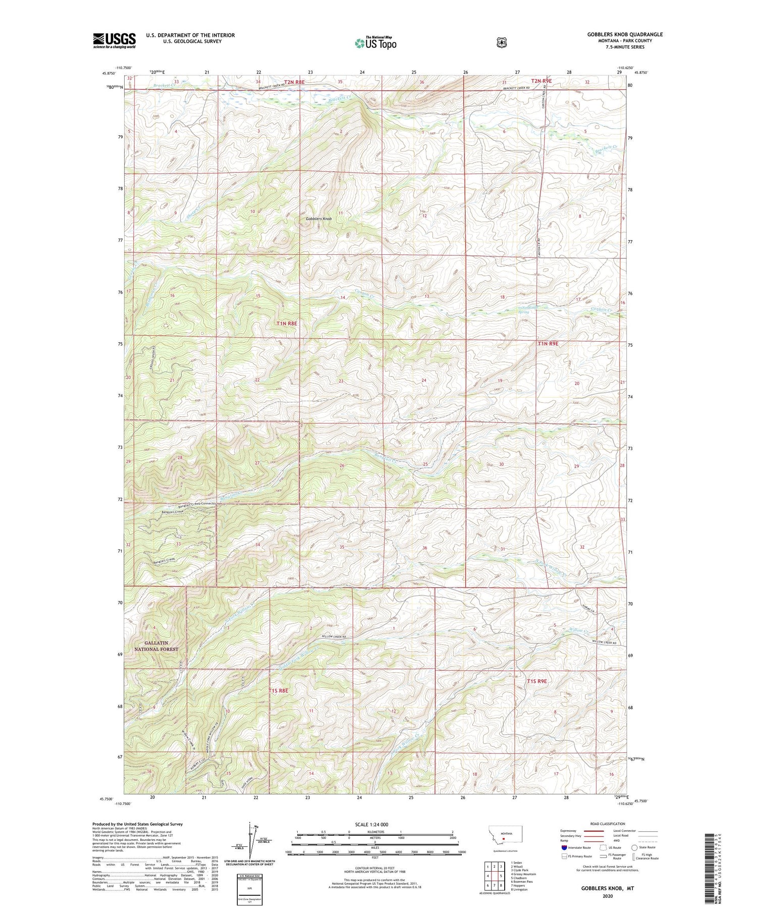
2020 topographic map quadrangle Gobblers Knob in the state of Montana. Scale: 1:24000. Based on the newly updated USGS 7.5' US Topo map series, this map is in the following counties: Park. The map contains contour data, water features, and other items you are used to seeing on USGS maps, but also has updated roads and other features. This is the next generation of topographic maps. Printed on high-quality waterproof paper with UV fade-resistant inks.
Quads adjacent to this one:
West: Grassy Mountain
Northwest: Sedan
North: Wilsall
Northeast: Clyde Park
East: Chadborn
Southeast: Livingston
South: Hoppers
Southwest: Bozeman Pass
Contains the following named places: 01N09E18D___01 Spring, Bridgman Creek, Fox Creek, Gibson Ranch, Gobblers Knob, Grouse Creek, Hansen Ranch, Middle Fork Willow Creek, Scott Ranch, Sheep Creek, South Fork Willow Creek, Terry Sheep Camp, Ward Ranch, Weed Ranch, Willow Creek Ranch


