MyTopo
Henderson Mountain Montana US Topo Map
Couldn't load pickup availability
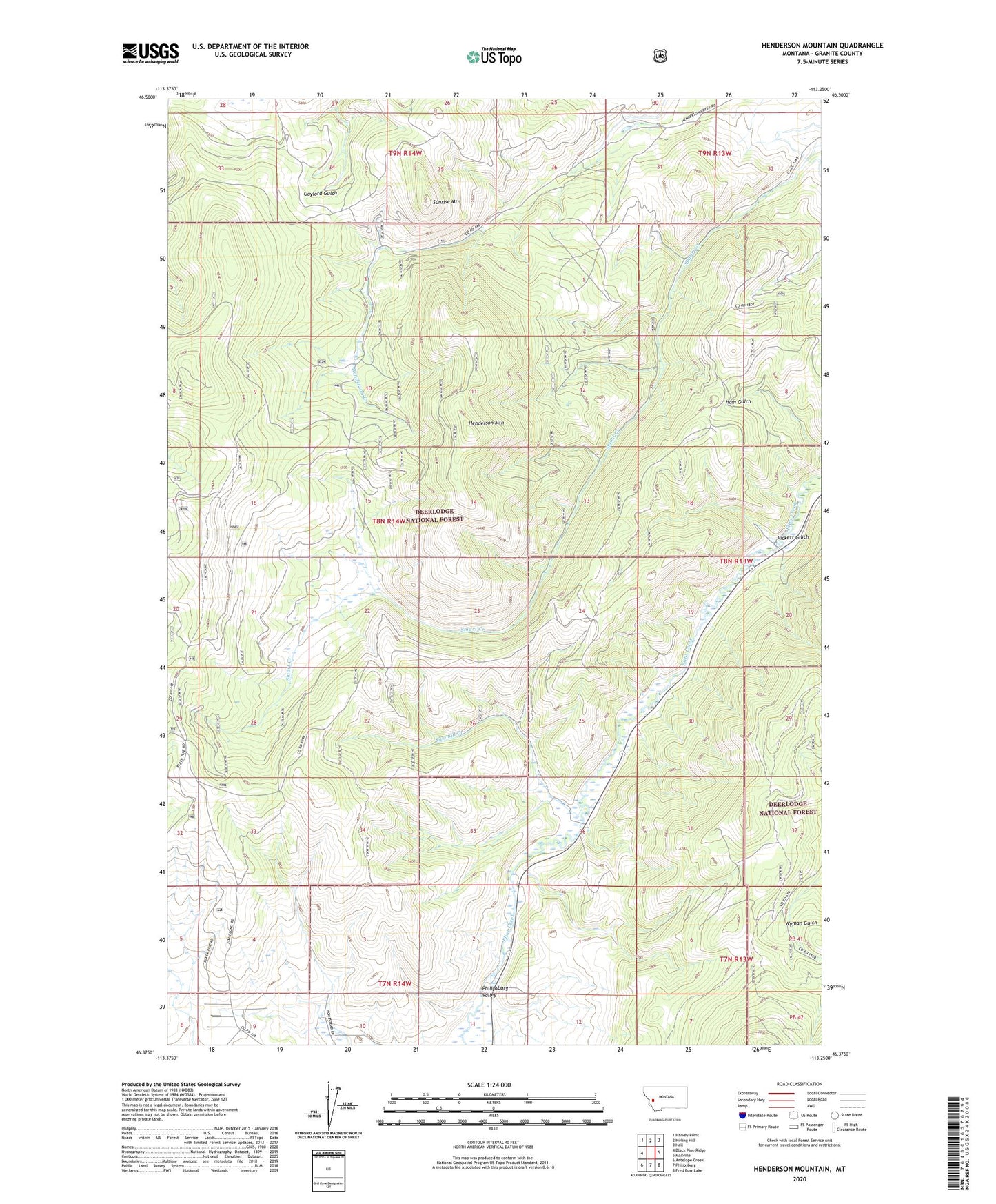
2020 topographic map quadrangle Henderson Mountain in the state of Montana. Scale: 1:24000. Based on the newly updated USGS 7.5' US Topo map series, this map is in the following counties: Granite. The map contains contour data, water features, and other items you are used to seeing on USGS maps, but also has updated roads and other features. This is the next generation of topographic maps. Printed on high-quality waterproof paper with UV fade-resistant inks.
Quads adjacent to this one:
West: Black Pine Ridge
Northwest: Harvey Point
North: Nirling Hill
Northeast: Hall
East: Maxville
Southeast: Fred Burr Lake
South: Philipsburg
Southwest: Antelope Creek
Contains the following named places: Bennett, Black Pine, Black Pine Mine, Black Pine School, Bunker Hill Mine, Combination Post Office, Copper State Mine, Hattie Mine, Henderson, Henderson Mountain, Lower Willow Creek Trail Number Four, Morse and Kennedy Mine, Nabbs Spur, North Star Mine, North Sunrise Mine, Philipsburg Valley, Pickett Gulch, Sawmill Creek, Sawmill Creek Mine, SE Section 5 Mine, Sunrise, Sunrise Mine, Sunrise Mountain, Sunrise/Queen Mine, Toohy