MyTopo
Herron Park Montana US Topo Map
Couldn't load pickup availability
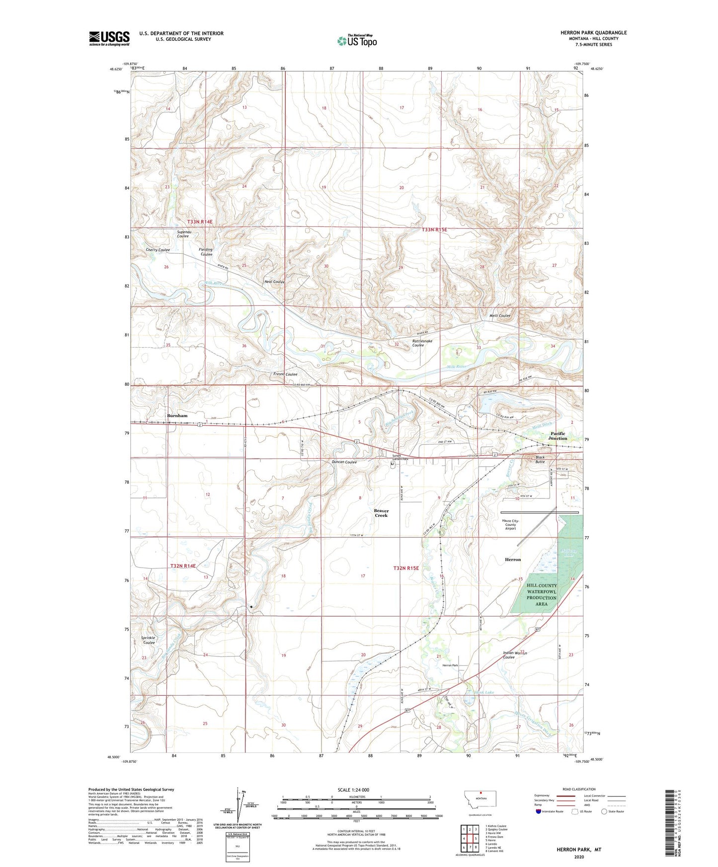
2024 topographic map quadrangle Herron Park in the state of Montana. Scale: 1:24000. Based on the newly updated USGS 7.5' US Topo map series, this map is in the following counties: Hill. The map contains contour data, water features, and other items you are used to seeing on USGS maps, but also has updated roads and other features. This is the next generation of topographic maps. Printed on high-quality waterproof paper with UV fade-resistant inks.
Quads adjacent to this one:
West: Fresno Dam
Northwest: Kiehns Coulee
North: Quigley Coulee
Northeast: Havre NW
East: Havre
Southeast: Cement Hill
South: Laredo NE
Southwest: Laredo
This map covers the same area as the classic USGS quad with code o48109e7.
Contains the following named places: 32N14E25BB__01 Well, 32N14E25DA__01 Well, 32N15E17DD__01 Well, 32N15E17DDDC01 Well, 32N15E21BB__01 Well, 32N15E28ACAA01 Well, 32N15E28ACDA01 Well, 32N15E28ADCD01 Well, 32N15E29ADDA01 Well, 32N15E29ADDA02 Well, 32N15E29ADDB01 Well, 32N15E29ADDC01 Well, 32N15E29ADDD01 Well, Assinniboine, Beaver Creek, Beaver Creek Census Designated Place, Beaver Creek Golf Course, Big Sandy Creek, Black Butte, Capudj Dam, Cherry Coulee, Cypress, Cypress School, Duncan Coulee, Evergreen Campground, Fielding Coulee, Fort Assinniboine, Fort Assinniboine Historical Marker, Fort Assinniboine Historical Site, Fort Assinniboine Military Reservation, Fort Assinniboine Post Office, Fresno Coulee, Halfway Lake, Harroum Coulee, Havre City-County Airport, Havre Irrigation Ditch, Herron, Herron Census Designated Place, Herron Park, Hill County Waterfowl Production Area, Indian Woman Coulee, Meili Coulee, Meill Ditch, Milk River Badlands, Mission Mountain Dam, Neal Coulee, Pacific Junction, Powers Post, Rattlesnake Coulee, Sprinkle Coulee, Stink Lake, Sunset Garden Park, Supenau Coulee, Thackery Ranch, Tiger Ridge Gas Field