MyTopo
Hoppers Montana US Topo Map
Couldn't load pickup availability
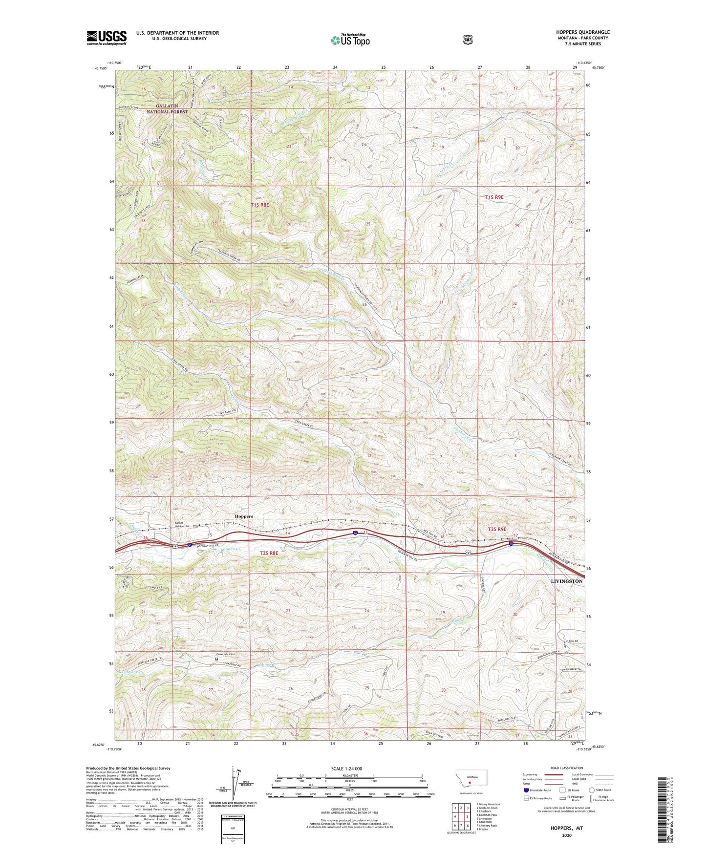
2020 topographic map quadrangle Hoppers in the state of Montana. Scale: 1:24000. Based on the newly updated USGS 7.5' US Topo map series, this map is in the following counties: Park. The map contains contour data, water features, and other items you are used to seeing on USGS maps, but also has updated roads and other features. This is the next generation of topographic maps. Printed on high-quality waterproof paper with UV fade-resistant inks.
Quads adjacent to this one:
West: Bozeman Pass
Northwest: Grassy Mountain
North: Gobblers Knob
Northeast: Chadborn
East: Livingston
Southeast: Brisbin
South: Chimney Rock
Southwest: Bald Knob
Contains the following named places: 02S09E05C___01 Well, 02S09E21C___01 Well, Area Creek, Coal Spur, Cokedale, Cokedale Cemetery, Cokedale Mines Number 1, Cokedale Mines Number 2, Cokedale Post Office, Cokedale School, Eldridge Creek, Flynn Creek, Haymond School, Hoppers, Miner Creek, Perkins Creek, Spring Creek, Tunnel Number 1, Williams Post Office