MyTopo
Haynie Reservoir Montana US Topo Map
Couldn't load pickup availability
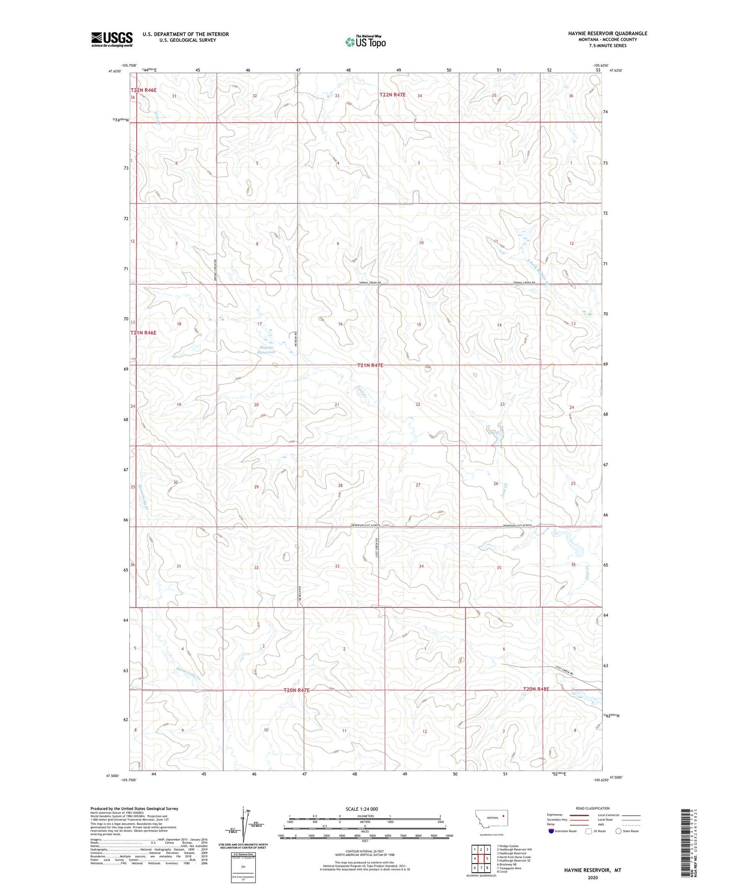
2024 topographic map quadrangle Haynie Reservoir in the state of Montana. Scale: 1:24000. Based on the newly updated USGS 7.5' US Topo map series, this map is in the following counties: McCone. The map contains contour data, water features, and other items you are used to seeing on USGS maps, but also has updated roads and other features. This is the next generation of topographic maps. Printed on high-quality waterproof paper with UV fade-resistant inks.
Quads adjacent to this one:
West: North Fork Horse Creek
Northwest: Pedigo Coulee
North: Hudiburgh Reservoir NW
Northeast: Hudiburgh Reservoir
East: Hudiburgh Reservoir SE
Southeast: Circle
South: Youngquist Mine
Southwest: Brockway NE
This map covers the same area as the classic USGS quad with code o47105e6.
Contains the following named places: 20N47E04BBBB01 Well, 20N47E04DCBD01 Well, 20N47E04DCCB01 Well, 20N47E10ACBD01 Well, 20N48E06CAAC01 Well, 20N48E06DCDD01 Well, 20N48E07BDAC01 Well, 20N48E08CDCA01 Well, 21N47E03CDAC01 Well, 21N47E03CDCC01 Well, 21N47E04BCAA01 Well, 21N47E08CDCD01 Well, 21N47E10ABBC01 Well, 21N47E10ADDD01 Well, 21N47E17BDDA01 Well, 21N47E17DAAB01 Well, 21N47E17DAAD01 Well, 21N47E18DCAA01 Well, 21N47E21DBAC01 Well, 21N47E31CACC01 Well, 21N47E31CCCC01 Well, 21N47E36ABBC01 Well, Angie Dam, Hainie Reservoir Dam, Haynie Reservoir, Nerud Ranch Number 1 Dam, Wahl Stock Reservoir Dam