MyTopo
Lozeau Montana US Topo Map
Couldn't load pickup availability
Also explore the Lozeau Forest Service Topo of this same quad for updated USFS data
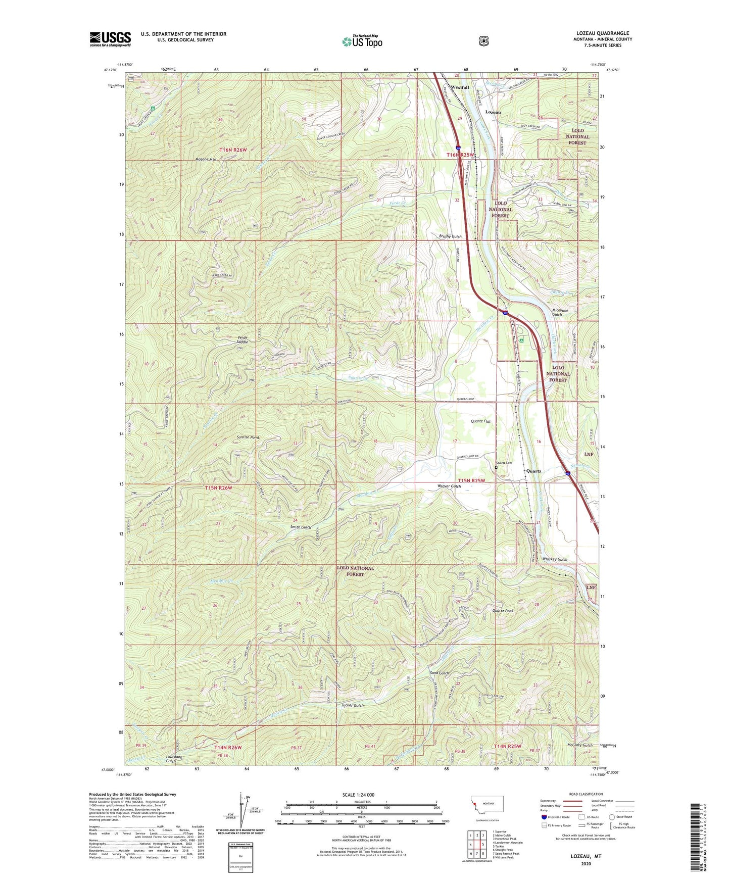
2024 topographic map quadrangle Lozeau in the state of Montana. Scale: 1:24000. Based on the newly updated USGS 7.5' US Topo map series, this map is in the following counties: Mineral. The map contains contour data, water features, and other items you are used to seeing on USGS maps, but also has updated roads and other features. This is the next generation of topographic maps. Printed on high-quality waterproof paper with UV fade-resistant inks.
Quads adjacent to this one:
West: Landowner Mountain
Northwest: Superior
North: Idaho Gulch
Northeast: Horsehead Peak
East: Tarkio
Southeast: Williams Peak
South: Saint Patrick Peak
Southwest: Straight Peak
This map covers the same area as the classic USGS quad with code o47114a7.
Contains the following named places: Bluff City, Brushy Gulch, Cayuse Creek, Cobden, Cobden School, Crescent City, Deep Creek, Eagle Rock Saddle, Eddy Creek, Forest Grove Fishing Access Site, Fortysix Creek, Iron Mountain Mine Historical Marker, Joe Doris Mine, Louisiana Gulch, Lozeau, Lozeau Post Office, Lucky 7 Mine, Magone Mountain, McFarland Creek, Meadow Creek, Micayune Gulch, Nellie Creek, Nemote Creek, Purtle, Quartz, Quartz Cemetery, Quartz Creek, Quartz Creek Mine, Quartz Fishing Access Site, Quartz Flat, Quartz Flat Campground, Quartz Flats Rest Area, Quartz Guard Station, Quartz Peak, Quartz Post Office, Quartz School, Saint Patrick Creek, Sand Gulch, Second Creek, Smith Gulch, Sunrise Creek, Sunrise Point, Texas Bar, Triangle Mine, Trout Creek Campground, Tucker Gulch, Verde Creek, Verde Saddle, Weaver Gulch, Westfall, Westfall Creek, Westfall School, Whiskey Gulch, Wingo Mine, X-Ray Vision Mine