MyTopo
Rapids Montana US Topo Map
Couldn't load pickup availability
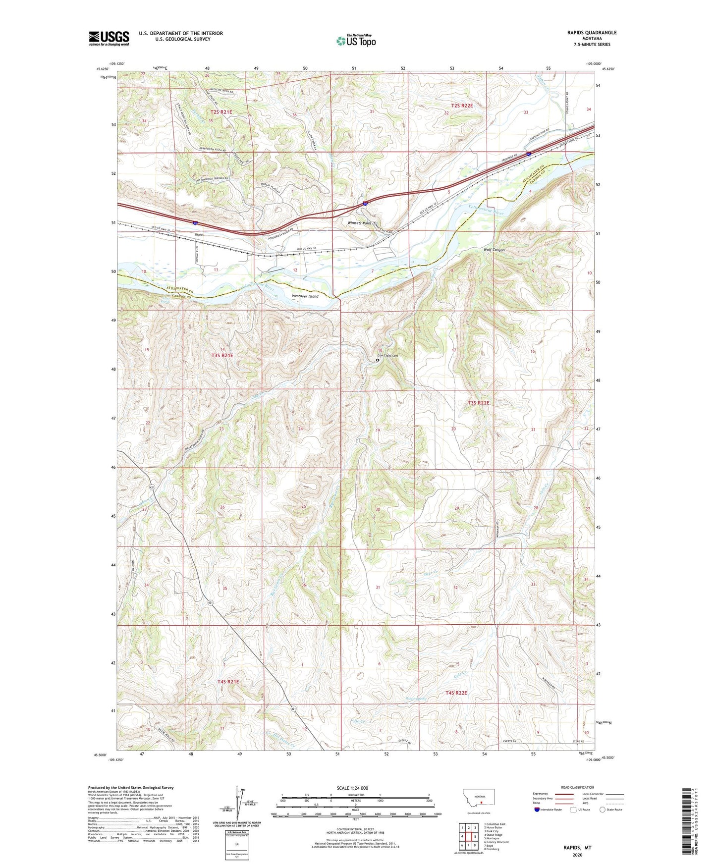
2020 topographic map quadrangle Rapids in the state of Montana. Scale: 1:24000. Based on the newly updated USGS 7.5' US Topo map series, this map is in the following counties: Carbon, Stillwater. The map contains contour data, water features, and other items you are used to seeing on USGS maps, but also has updated roads and other features. This is the next generation of topographic maps. Printed on high-quality waterproof paper with UV fade-resistant inks.
Quads adjacent to this one:
West: Shane Ridge
Northwest: Columbus East
North: Horse Butte
Northeast: Park City
East: Montaqua
Southeast: Fromberg
South: Boyd
Southwest: Cooney Reservoir
Contains the following named places: 03S21E35BACA01 Well, 03S22E06CBDB01 Well, 03S22E06CCAA01 Well, 03S22E21BADD01 Well, Allen Creek, Cow Creek, Cow Creek Cemetery, Cow Creek School, Deer Creek, Monahan School, Poison Spring, Rapids, Rapids Post Office, Rye Grass Creek, Tilden Creek, Trout Rapids, Tucker Creek, Westover Island, Wimsett Point, Wolf Canyon, Youngs Point