MyTopo
Rodgers Hall Montana US Topo Map
Couldn't load pickup availability
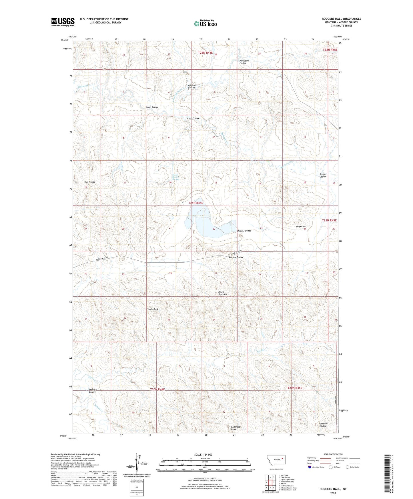
2020 topographic map quadrangle Rodgers Hall in the state of Montana. Scale: 1:24000. Based on the newly updated USGS 7.5' US Topo map series, this map is in the following counties: McCone. The map contains contour data, water features, and other items you are used to seeing on USGS maps, but also has updated roads and other features. This is the next generation of topographic maps. Printed on high-quality waterproof paper with UV fade-resistant inks.
Quads adjacent to this one:
West: Nelson Creek Bay
Northwest: Bug Creek
North: Crow Springs
Northeast: Figure Eight Creek
East: Weldon
Southeast: Johnson Coulee East
South: Johnson Coulee West
Southwest: Fortyfour Coulee
Contains the following named places: 20N45E05DDB_01 Well, 20N45E08DDAC01 Well, 21N44E04DCCB01 Well, 21N44E11CDAC01 Well, 21N44E11DCDA01 Well, 21N44E16DBCD01 Well, 21N44E23BBDC01 Well, 21N44E23CBCD01 Well, 21N44E24BDCC01 Well, 21N44E28DBCC01 Well, 21N44E28DCB_01 Well, 21N45E07BCDD01 Well, 22N44E23DDBC01 Well, 22N44E35BAAA01 Well, 22N44E35BACB01 Well, 22N44E35BACB02 Well, 22N44E36CBBB01 Well, Anderson Coulee, Badgley Coulee, Coal Creek, Devils Table Rock, Eagle Rock, Kurth Coulee, Kvam Coulee, McDonald Butte, North Fork McGuire Creek, Paine Dam, Porcupine Coulee, Rodgers Coulee, Rodgers Hall, Romine Divide, School Section Springs, Towe Farms Number 3 Dam