MyTopo
Johnson Coulee East Montana US Topo Map
Couldn't load pickup availability
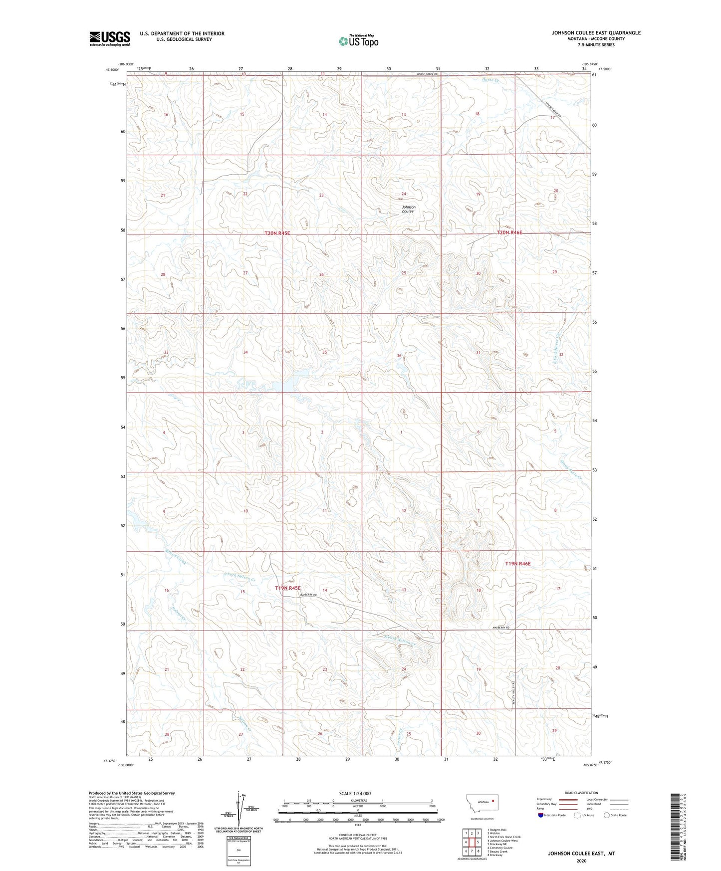
2024 topographic map quadrangle Johnson Coulee East in the state of Montana. Scale: 1:24000. Based on the newly updated USGS 7.5' US Topo map series, this map is in the following counties: McCone. The map contains contour data, water features, and other items you are used to seeing on USGS maps, but also has updated roads and other features. This is the next generation of topographic maps. Printed on high-quality waterproof paper with UV fade-resistant inks.
Quads adjacent to this one:
West: Johnson Coulee West
Northwest: Rodgers Hall
North: Weldon
Northeast: North Fork Horse Creek
East: Brockway NE
Southeast: Brockway
South: Beauty Creek
Southwest: Cemetery Coulee
This map covers the same area as the classic USGS quad with code o47105d8.
Contains the following named places: 19N45E04ABBA01 Well, 19N45E09DCCD01 Well, 19N45E10DDCA01 Well, 19N45E11ACCD01 Well, 19N45E16ABAB01 Well, 19N45E22BBAC01 Well, 19N46E08ACDA01 Well, 19N46E08CDAC01 Well, 19N46E08CDDB01 Well, 19N46E17ADBD01 Well, 19N46E29CAAA01 Well, 20N45E10DCCD01 Well, 20N45E22BCCA01 Well, 20N45E22DACC01 Well, 20N45E27ACCC01 Well, 20N45E28BABD01 Well, 20N45E34CAAB01 Well, 20N45E35DAAB01 Well, 20N46E19BBAC01 Well, 20N46E20CADA01 Well, L Quick Dam, Murphy and Sons Number 2 Dam, Murphy Number 1 Dam, Nelson Creek Post Office, Waller Dam