MyTopo
Scraper Coulee Montana US Topo Map
Couldn't load pickup availability
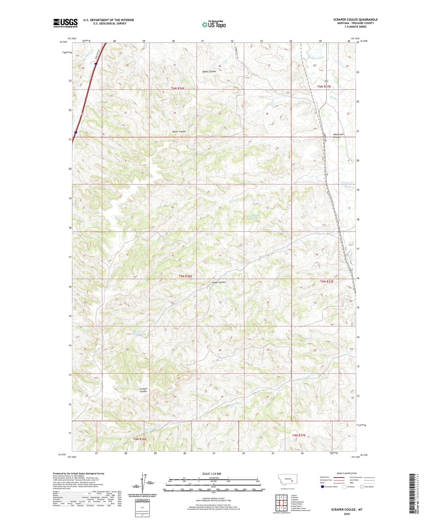
2020 topographic map quadrangle Scraper Coulee in the state of Montana. Scale: 1:24000. Based on the newly updated USGS 7.5' US Topo map series, this map is in the following counties: Treasure. The map contains contour data, water features, and other items you are used to seeing on USGS maps, but also has updated roads and other features. This is the next generation of topographic maps. Printed on high-quality waterproof paper with UV fade-resistant inks.
Quads adjacent to this one:
West: Eldering Ranch
Northwest: Myers
North: Hysham
Northeast: Sanders
East: Woods Water
Southeast: Minnehaha Creek North
South: South Bear Creek
Southwest: Hope Ranch
Contains the following named places: 05N36E10ACDA01 Well, 05N36E15BACD01 Well, 05N36E22CACD01 Well, 05N37E31BAAD01 Well, 06N36E36A___01 Well, 06N37E30DCAC01 Well, 06N37E31ACBA01 Well, 59038, Buffalo and Indians Historical Marker, Cedar Coulee, Garverich Number 1 Dam, Garverich Ranch, Garverich Spring, Hysham Rest Area, Loeffler School, Loyd Criswell School, Moon School, Sandrock Spring, Swede Creek, Sweetzer Dam, The Yellowstone by Wallace McRae Historical Marker, Whitcomb Coulee, Wright School