MyTopo
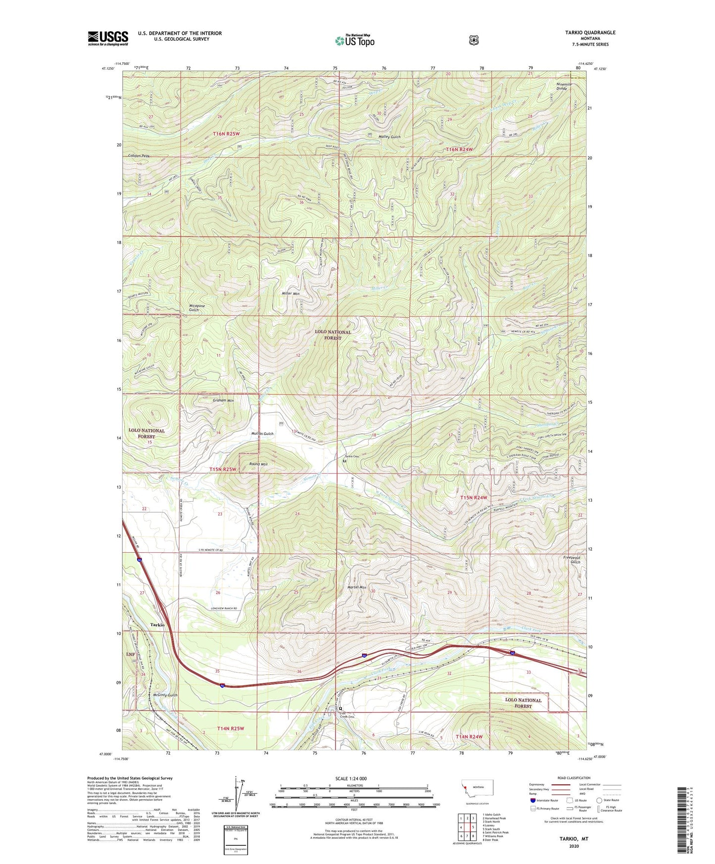
Tarkio Montana US Topo Map
Couldn't load pickup availability
Also explore the Tarkio Forest Service Topo of this same quad for updated USFS data
2024 topographic map quadrangle Tarkio in the state of Montana. Scale: 1:24000. Based on the newly updated USGS 7.5' US Topo map series, this map is in the following counties: Mineral, Missoula. The map contains contour data, water features, and other items you are used to seeing on USGS maps, but also has updated roads and other features. This is the next generation of topographic maps. Printed on high-quality waterproof paper with UV fade-resistant inks.
Quads adjacent to this one:
West: Lozeau
Northwest: Idaho Gulch
North: Horsehead Peak
Northeast: Stark North
East: Stark South
Southeast: Deer Peak
South: Williams Peak
Southwest: Saint Patrick Peak
This map covers the same area as the classic USGS quad with code o47114a6.
Contains the following named places: Alice Creek, Bear Creek, Cobden Peak, Fish Creek, Fish Creek Cemetery, Fish Creek School, Gold King Mine, Graham Mountain, Malley Gulch, Martel Mountain, McGinty Gulch, Miller Creek, Miller Mountain, Mouth of Fish Creek Fishing Access Site, Mullan Gulch, Ribulet School, Rivulet, Rivulet Post Office, Roosevelt Mine, Round Mountain, Sheridan Creek, South Fork Deep Creek, South Fork Nemote Creek, Tarkio, Tarkio Cemetery, Tarkio East Fishing Access Site, Tarkio Post Office, Tarkio School, Tarkio West Fishing Access Site