
MyTopo
Sun River Montana US Topo Map
Couldn't load pickup availability
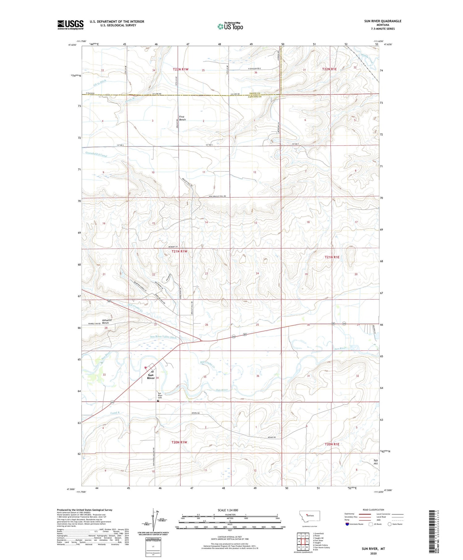
2020 topographic map quadrangle Sun River in the state of Montana. Scale: 1:24000. Based on the newly updated USGS 7.5' US Topo map series, this map is in the following counties: Cascade, Teton. The map contains contour data, water features, and other items you are used to seeing on USGS maps, but also has updated roads and other features. This is the next generation of topographic maps. Printed on high-quality waterproof paper with UV fade-resistant inks.
Quads adjacent to this one:
West: Fort Shaw
Northwest: Greenfield
North: Power
Northeast: Vaughn NE
East: Vaughn
Southeast: Ulm
South: Fair Haven Colony
Southwest: Cascade Colony
Contains the following named places: 20N01W02B___01 Well, 21N01W22CCDA01 Well, 21N01W22DCCA01 Well, 21N01W25A___01 Well, 21N01W26CAAD01 Well, 21N01W27A___01 Well, 21N01W34A___01 Well, 21N01W36B___01 Well, 59487, Dracut Junction, Government Farm, Largent, Mill Coulee Creek, Project Post Office, Sun River, Sun River Cemetery, Sun River Census Designated Place, Sun River Middle School, Sun River Post Office, Sun River Valley Church, Sun River Valley Ditch, Sun River Volunteer Fire Department


