MyTopo
Toney Bench Montana US Topo Map
Couldn't load pickup availability
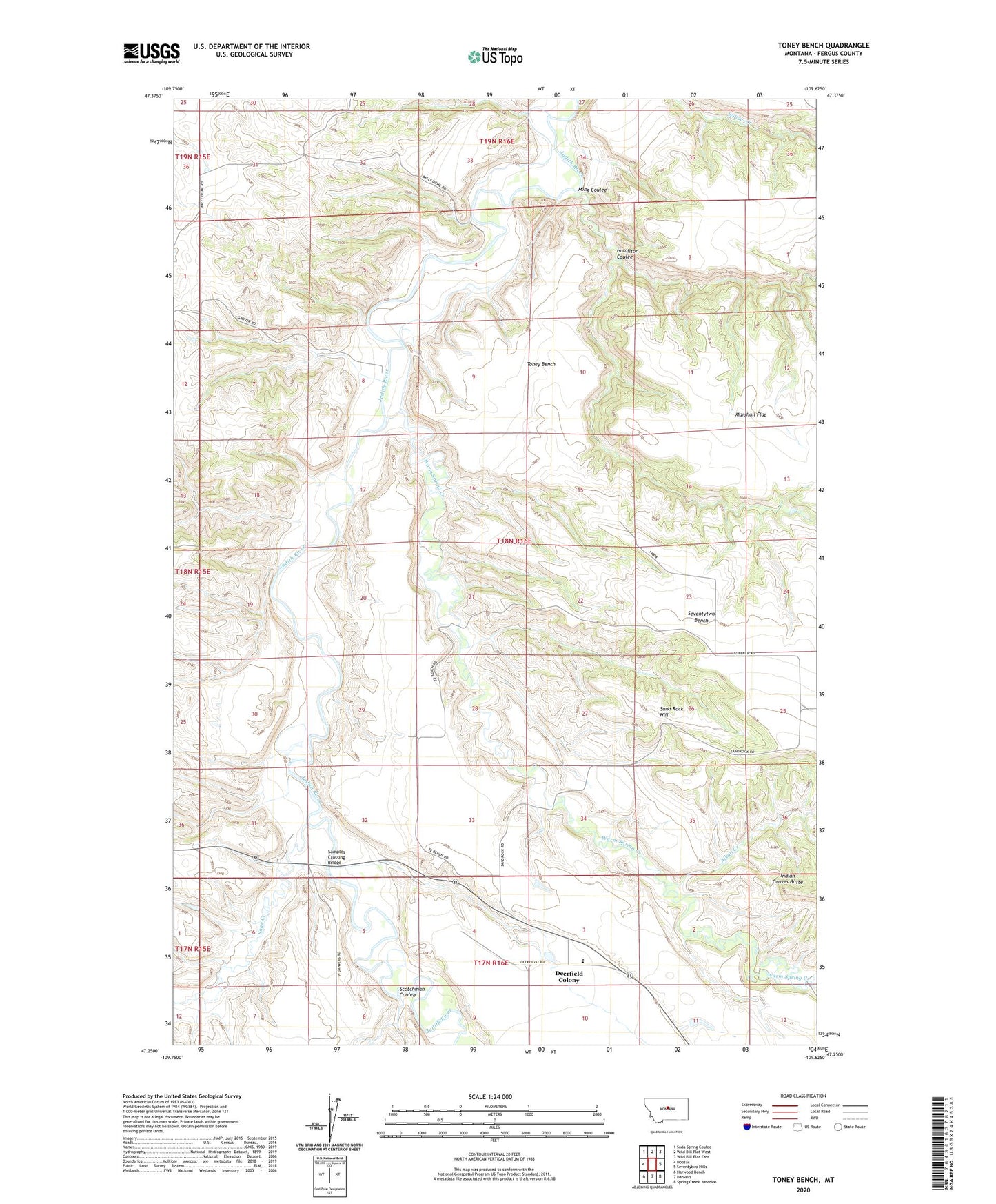
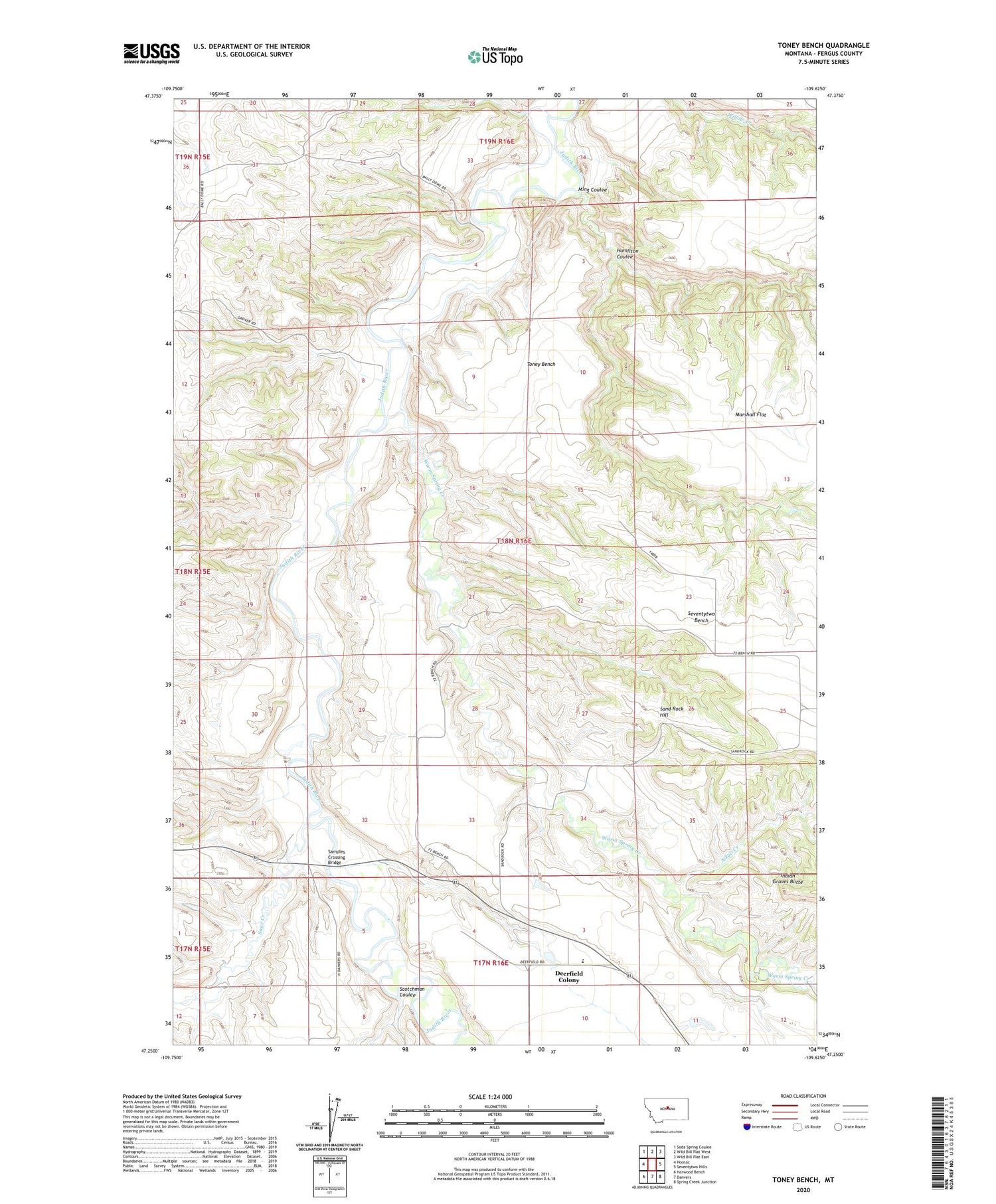
2020 topographic map quadrangle Toney Bench in the state of Montana. Scale: 1:24000. Based on the newly updated USGS 7.5' US Topo map series, this map is in the following counties: Fergus. The map contains contour data, water features, and other items you are used to seeing on USGS maps, but also has updated roads and other features. This is the next generation of topographic maps. Printed on high-quality waterproof paper with UV fade-resistant inks.
Quads adjacent to this one:
West: Hoosac
Northwest: Soda Spring Coulee
North: Wild Bill Flat West
Northeast: Wild Bill Flat East
East: Seventytwo Hills
Southeast: Spring Creek Junction
South: Danvers
Southwest: Harwood Bench
Contains the following named places: 17N16E03ACDD01 Well, 18N16E23CBD_01 Well, Ackerley School, Alkali Creek, Deerfield Colony, Deerfield Colony Census Designated Place, Deerfield Post Office, Deerfield School, Hamilton Coulee, Indian Graves Butte, Judith Bend School, Marshall Flat, Ming Coulee, Pleasant View School, Sage Creek, Samples Crossing, Samples Crossing Bridge, Sand Rock Hill, Scotchman Coulee, Seventytwo Bench, Toney Bench, Warm Spring Creek