MyTopo
Ayr Nebraska US Topo Map
Couldn't load pickup availability
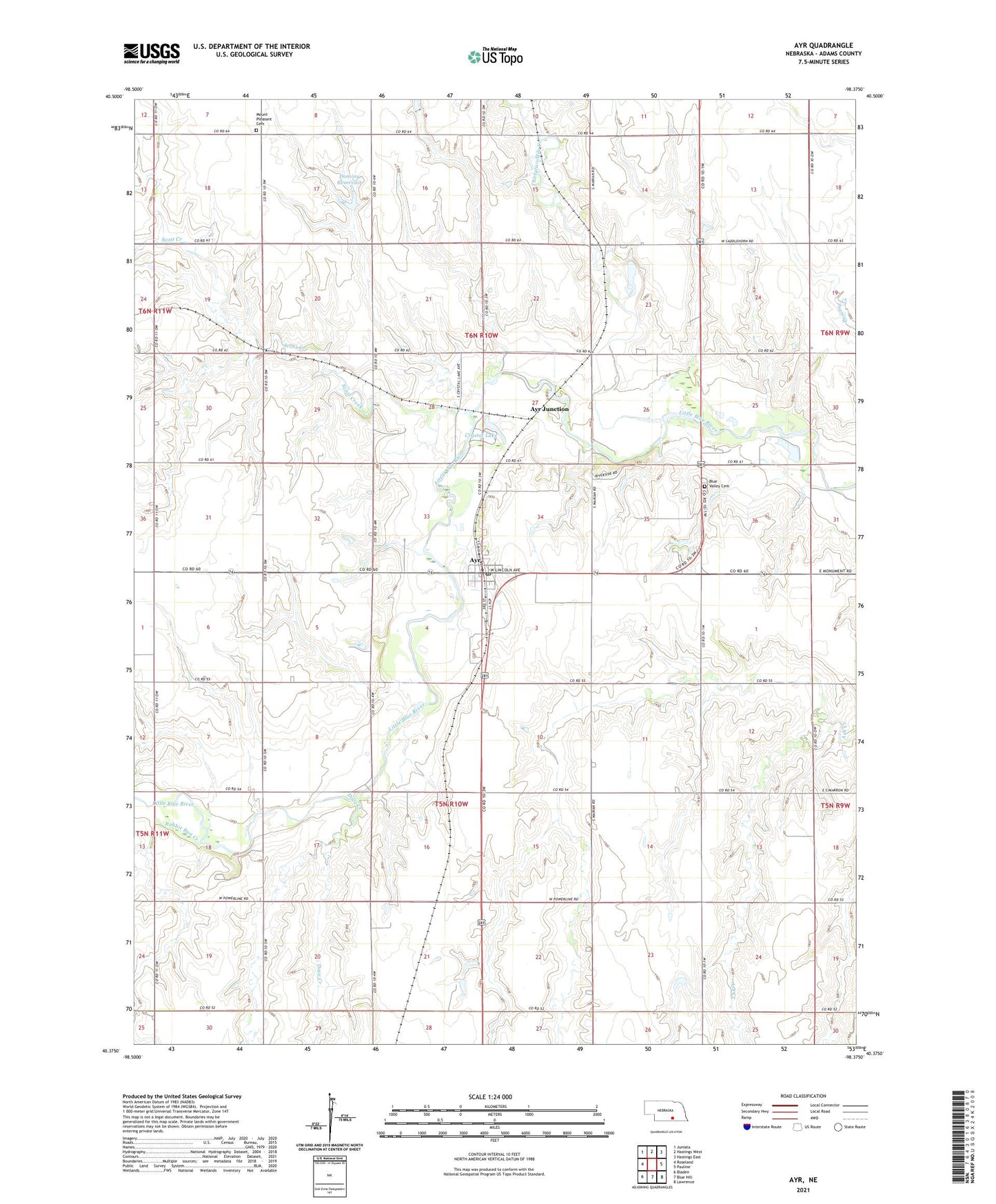
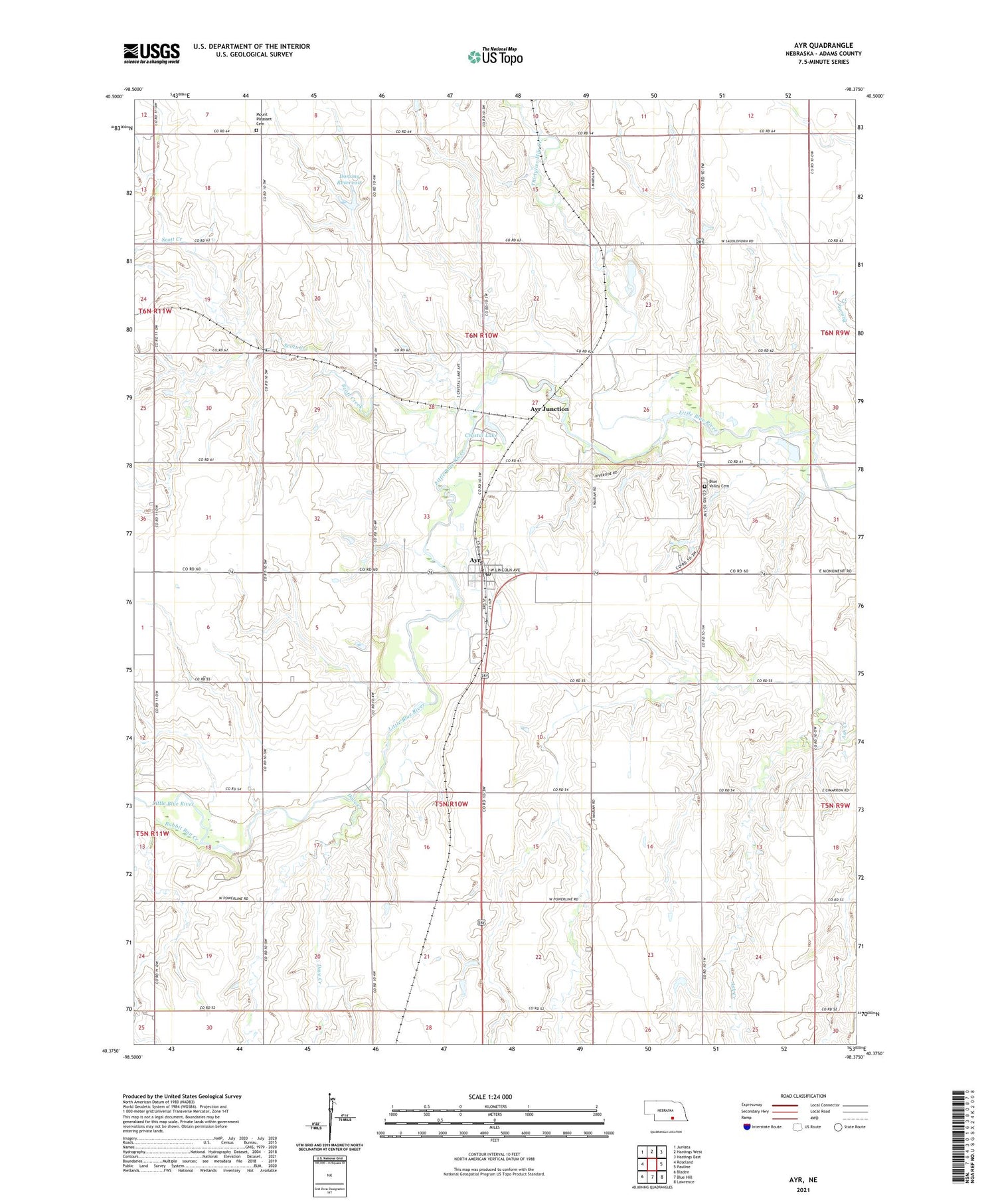
2021 topographic map quadrangle Ayr in the state of Nebraska. Scale: 1:24000. Based on the newly updated USGS 7.5' US Topo map series, this map is in the following counties: Adams. The map contains contour data, water features, and other items you are used to seeing on USGS maps, but also has updated roads and other features. This is the next generation of topographic maps. Printed on high-quality waterproof paper with UV fade-resistant inks.
Quads adjacent to this one:
West: Roseland
Northwest: Juniata
North: Hastings West
Northeast: Hastings East
East: Pauline
Southeast: Lawrence
South: Blue Hill
Southwest: Bladen
This map covers the same area as the classic USGS quad with code o40098d4.
Contains the following named places: Ayr, Ayr Grain Cooperative Elevator, Ayr Junction, Ayr Post Office, Ayr Public School, Blue Valley Cemetery, Brickton, Camp Snyder, Crystal Lake, Crystal Lake Campground, Crystal Lake Historical Marker, Crystal Lake State Recreation Area, Deans, Dominy Dam, Dominy Dam Number 1, Dominy Reservoir, Dove Creek, Hastings Rural Fire Department Station 2, Kingston Cemetery Historical Marker, Mount Pleasant Cemetery, Plautz Dam, Plautz Reservoir, Rabbit Run Creek, Scott Creek, Thirtytwo Mile Creek, Township of Ayr, Township of Zero, Village of Ayr, ZIP Code: 68925