MyTopo
Lyman Nebraska US Topo Map
Couldn't load pickup availability
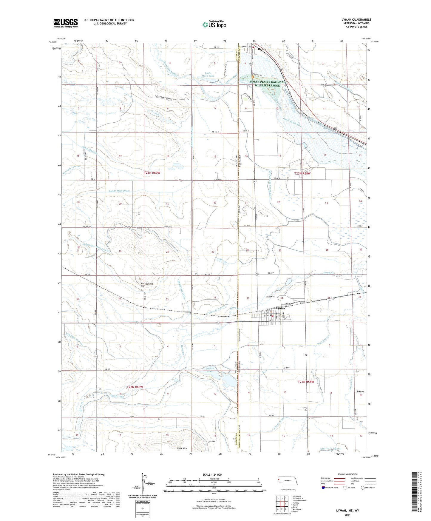
2021 topographic map quadrangle Lyman in the states of Wyoming, Nebraska. Scale: 1:24000. Based on the newly updated USGS 7.5' US Topo map series, this map is in the following counties: Scotts Bluff, Goshen. The map contains contour data, water features, and other items you are used to seeing on USGS maps, but also has updated roads and other features. This is the next generation of topographic maps. Printed on high-quality waterproof paper with UV fade-resistant inks.
Quads adjacent to this one:
West: Huntley
Northwest: Torrington
North: Torrington SE
Northeast: Dry Sheep Creek
East: Morrill
Southeast: Stegall
South: Robb Draw
Southwest: Duroc
Contains the following named places: Branch A, Canal, Centennial Creek, Christian Church, East Springer Lateral, East Springer Main Lateral, Gering-Mitchell Canal, Henry, Henry Post Office, Henry Volunteer Fire Department, Horse Creek, Horse Creek Treaty Historical Marker, Immanuel United Church, Katzer Drain Branch, Kelley Bean Company Incorporated Elevator, Kiowa, Kiowa Creek, Little Moon Lake, Lyman, Lyman Elevator Company Elevator, Lyman Police Department, Lyman Post Office, Lyman Public Library, Lyman Volunteer Fire Department, McElhaney Drain, North Horse Creek Lateral, Owl Creek, Packer Ditch, Packer Lake, Rattlesnake Hill, School Number 81, Sears, Table Mountain, Tri-State Diversion Dam, Tri-State Diversion Reservoir, Village of Henry, Village of Lyman