MyTopo
Deeth Nevada US Topo Map
Couldn't load pickup availability
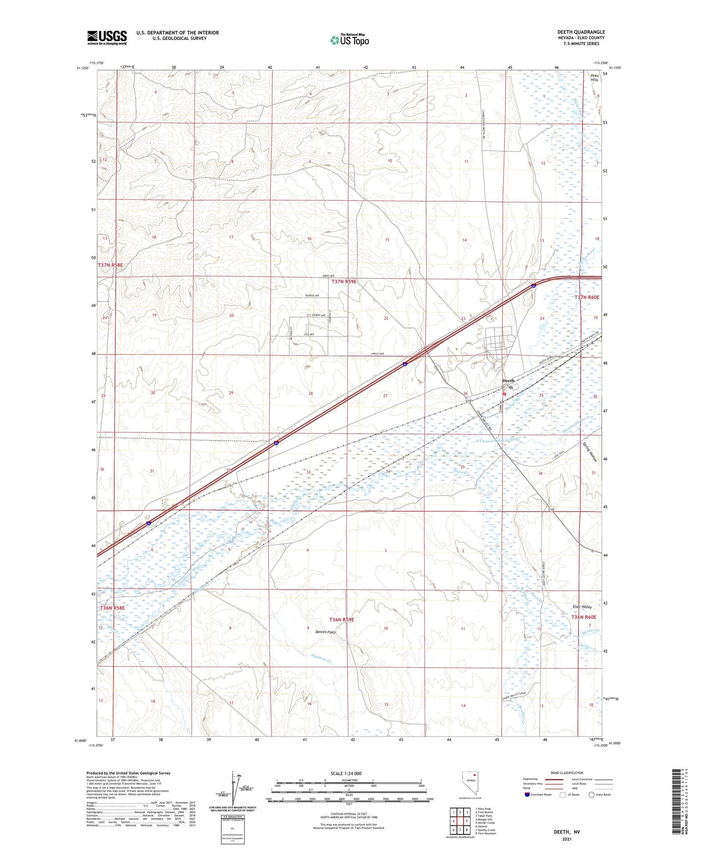
2021 topographic map quadrangle Deeth in the state of Nevada. Scale: 1:24000. Based on the newly updated USGS 7.5' US Topo map series, this map is in the following counties: Elko. The map contains contour data, water features, and other items you are used to seeing on USGS maps, but also has updated roads and other features. This is the next generation of topographic maps. Printed on high-quality waterproof paper with UV fade-resistant inks.
Quads adjacent to this one:
West: Morgan Hill
Northwest: Peko Peak
North: Twin Buttes
Northeast: Tabor Flats
East: Herder Creek
Southeast: Tent Mountain
South: Heelfly Creek
Southwest: Halleck
This map covers the same area as the classic USGS quad with code o41115a3.
Contains the following named places: Ackler Creek, Boulder Creek, Deeth, Deeth Post Office, Deeth Volunteer Fire Department, East Channel Marys River, Herder Creek, Marble Well, Marys River, Natchez, Sagebrush Well, Spring Hollow, Starr Creek, Stephens Creek, ZIP Code: 89823